Bug report #9655

Strange behavior of labeling for multipolygons, due to geometry simplification
| Status: | Closed | ||
|---|---|---|---|
| Priority: | High | ||
| Assignee: | |||
| Category: | Labelling | ||
| Affected QGIS version: | 2.2.0 | Regression?: | No |
| Operating System: | Easy fix?: | No | |
| Pull Request or Patch supplied: | Yes | Resolution: | fixed/implemented |
| Crashes QGIS or corrupts data: | No | Copied to github as #: | 18223 |
Description
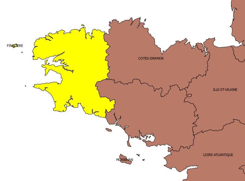
For labeling multipolygons it seems that sometimes the label is placed on rather small parts of the shape, whereas there is plenty of room to place the label elsewhere. In the attached example, islands are labeled instead of mainland.
In some cases, the label is not displayed at all for the whole shape, whereas there is obviously enough room to place the label.
The behavior depends on the scale and what part of the feature is displayed.
Many Thanks
Related issues
History
#1
 Updated by Larry Shaffer over 12 years ago
- Assignee set to Larry Shaffer
- Target version set to Version 2.4
Hi Augustin,
Can you please share the data and project?
Is this with Label every part of multi-part features checked (under Labels->Rendering)?
In some cases, the label is not displayed at all for the whole shape, whereas there is obviously enough room to place the label.
Occasionally, when features are clipped to the extent (during the current labeling process), their geometries become invalid and are then not labeled.
#2
 Updated by Augustin Roche over 12 years ago
- File data_test.zip added
Here is sample data that shows the problem.
#3
Updated by Larry Shaffer over 12 years ago
It seems to be an issue with the new geometry simplification. Under Vector Layer Properties -> Rendering, uncheck Simplify geometry. The layer is then labeled correctly here, with the largest geometry getting the label (unless Label every part of multi-part features is checked, of course).
Please verify my results.
It seems that during on-the-fly geometry simplification your coastlines return invalid geometries, which will not be labeled.
While turning off geometry simplification avoids the issue, it is still a bug that needs addressed.
#4
Updated by Larry Shaffer over 12 years ago
- Priority changed from Normal to High
- Subject changed from Strange behavior of labeling for multipolygons to Strange behavior of labeling for multipolygons, due to geometry simplification
#5
Updated by Larry Shaffer over 12 years ago
Hi Alvaro,
I added you as a watcher to this issue, since I believe it is directly related to the new geometry simplification.
Regards,
Larry
#6
Updated by Augustin Roche over 12 years ago
Indeed turning off on-the-fly simplification solves the labeling problems.
Many thanks,
Augustin
#7
 Updated by Alvaro Huarte over 12 years ago
Larry Shaffer wrote:
Hi Alvaro,
I added you as a watcher to this issue, since I believe it is directly related to the new geometry simplification.
Regards,
Larry
Hi Larry, I can try to solve this issue, are you agree ?
#8
Updated by Larry Shaffer over 12 years ago
- Assignee changed from Larry Shaffer to Alvaro Huarte
Alvaro Huarte wrote:
Hi Larry, I can try to solve this issue, are you agree ?
Yes, please do. I assigned the issue to you. I'm pretty busy with work on labeling unit tests, so don't really have time to review/learn your simplification code now.
Thanks!
Ultimately, and for 2.3, we should seriously look at including liblwgeom support, or something similar, to introduce on-the-fly fixing of invalid geometry. This has been discussed multiple times in the past.
There is also the prepair lib, as discussed previously. However, it requires an additional dependency on CGAL.
Such a feature will also help with labeling all invalid geometries, not just those possibly resulting from simplification, etc., as well as general fixing of invalid geometries.
#9
Updated by Alvaro Huarte over 12 years ago
Larry Shaffer wrote:
Alvaro Huarte wrote:
Hi Larry, I can try to solve this issue, are you agree ?
Yes, please do. I assigned the issue to you. I'm pretty busy with work on labeling unit tests, so don't really have time to review/learn your simplification code now.
Thanks!
Ultimately, and for 2.3, we should seriously look at including liblwgeom support, or something similar, to introduce on-the-fly fixing of invalid geometry. This has been discussed multiple times in the past.
There is also the prepair lib, as discussed previously. However, it requires an additional dependency on CGAL.
Such a feature will also help with labeling all invalid geometries, not just those possibly resulting from simplification, etc., as well as general fixing of invalid geometries.
Ok, I study it!
#10
Updated by Larry Shaffer over 12 years ago
Hi Alvaro,
Of note: liblwgeom is part of PostGIS, but is basically available as a separate package for the major QGIS platforms. It would be good to utilize it without incurring a additional dependency upon PostGIS/PostgreSQL.
It may be reasonable to just embed its source within QGIS as well, then just publicly expose its functionality via QgsGeometry functions.
#11
Updated by Alvaro Huarte over 12 years ago
Hi Larry, I fixed an error in the simplification algorithm. It created invalid polygons with two points:
https://github.com/qgis/QGIS/pull/1219
It is not related with the bad calculation of label position.
This error is throwed in 'QgsPalLabeling::drawLabeling()' method, it is very complex and I need some extra time to fix!
Alvaro
#12
Updated by Alvaro Huarte over 12 years ago
Alvaro Huarte wrote:
Larry Shaffer wrote:
Alvaro Huarte wrote:
Hi Larry, I can try to solve this issue, are you agree ?
Yes, please do. I assigned the issue to you. I'm pretty busy with work on labeling unit tests, so don't really have time to review/learn your simplification code now.
Thanks!
Ultimately, and for 2.3, we should seriously look at including liblwgeom support, or something similar, to introduce on-the-fly fixing of invalid geometry. This has been discussed multiple times in the past.
There is also the prepair lib, as discussed previously. However, it requires an additional dependency on CGAL.
Such a feature will also help with labeling all invalid geometries, not just those possibly resulting from simplification, etc., as well as general fixing of invalid geometries.
Ok, I study it!
Hi Larry, I agree with append MakeValid-functionality-to-QgsGeometry but IMHO it should not be applied after simplification because of it will be very slow to use in a rendering task, I think better fix the calculation of centroid of these invalid geometries.
#13
Updated by Larry Shaffer over 12 years ago
Alvaro Huarte wrote:
Hi Larry, I fixed an error in the simplification algorithm. It created invalid polygons with two points:
https://github.com/qgis/QGIS/pull/1219It is not related with the bad calculation of label position.
This error is throwed in 'QgsPalLabeling::drawLabeling()' method, it is very complex and I need some extra time to fix!
What error? I know the workings of that class pretty well.
The calculation of the centroid is currently in the PAL lib. However, there is an issue ticket for adding a better centroid solution that ensures the "label is always on top of the feature":#9480.
There will be a lot of changes upcoming in the QgsPalLabeling class. Including an attempt to fix geometries on-the-fly. But, if you wish to tackle the "better centroid" (issue #9480) for PAL, that would be great. Realize however, if the geometry is invalid, then it will never be registered with PAL to begin with. This doesn't mean that invalid geometries can't be used to create valid centroids, though. That is one approach for polygons, before registering with PAL.
#14
Updated by Alvaro Huarte over 12 years ago
Larry Shaffer wrote:
What error? I know the workings of that class pretty well.
I meant that it miscalculates the centroid when the geometry is invalid.
Thanks for your notes, I am testing QgsPalLabeling class.
#15
 Updated by Giovanni Manghi over 12 years ago
There is also the prepair lib, as discussed previously. However, it requires an additional dependency on CGAL.
see also #9521
#16
Updated by Alvaro Huarte over 12 years ago
PAL library already has a centroid algorithm forced within of the polygon.
It is assigned when the 'placement' property of the label configuration is equals to 'FREE'.
https://github.com/qgis/QGIS/blob/master/src/core/pal/feature.cpp#L1034
I want find where the PAL library fails using polygons with self-intersects edges.
Alvaro
#17
 Updated by Jürgen Fischer over 12 years ago
- Target version changed from Version 2.4 to Future Release - High Priority
#18
Updated by Larry Shaffer over 12 years ago
Giovanni Manghi wrote:
There is also the prepair lib, as discussed previously. However, it requires an additional dependency on CGAL.
see also #9521
Hi, Giovanni. The 'prepair' external library (fixes geometry) is different than 'prepared' GEOS geometry (which appears to be caching optimization in nature). However, the latter looks very interesting, indeed.
#19
Updated by Alvaro Huarte about 12 years ago
- Resolution set to fixed/implemented
- Pull Request or Patch supplied changed from No to Yes
I have changed how resolve the issue. I use 'buffer' method to convert the geometry to valid, and it works better
I added to pal::Layer a new 'ignoreInvalidGeometries' property to enable labeling of invalid geometries.I works fine, but it requires modify the code of PAL Labeling library (http://pal.heig-vd.ch).
See:https://github.com/ahuarte47/QGIS/commit/ad1e07c9e697db34c5ebc2b2c7c921a071a05dc1 in
https://github.com/qgis/QGIS/pull/1219
#20
Updated by Larry Shaffer about 12 years ago
- Resolution deleted (
fixed/implemented)
Hi Alvaro,
Your pull request doesn't fix the issue in my testing, using the provided sample project. (See other comment in request.)
With Simplify geometry ON, I do not get good results, e.g. if any extent clipping happens to the noted problematic simplified feature, it is never labeled. This includes only clipping off an island, which should leave a valid geometry. I think there is something else going on here, stemming from simplification of multi-geometry features (maybe?).
#21
Updated by Alvaro Huarte about 12 years ago
Larry Shaffer wrote:
Hi Alvaro,
Your pull request doesn't fix the issue in my testing, using the provided sample project. (See other comment in request.)
With Simplify geometry ON, I do not get good results, e.g. if any extent clipping happens to the noted problematic simplified feature, it is never labeled. This includes only clipping off an island, which should leave a valid geometry. I think there is something else going on here, stemming from simplification of multi-geometry features (maybe?).
Hi Larry, I have changed how resolve the issue. I use 'buffer' method to convert the geometry to valid, and it works better
#22
Updated by Larry Shaffer about 12 years ago
- Status changed from Open to Closed
- Resolution set to fixed/implemented
Hi Augustin,
Should be fixed with commit 245422a. Tested here on Mac OS X 10.7.5 and 10.9.2 with your test data. If not please reopen issue.