Bug report #13883

Scalebar problem in QGis 2.12.0
| Status: | Closed | ||
|---|---|---|---|
| Priority: | Normal | ||
| Assignee: | - | ||
| Category: | Map Composer/Printing | ||
| Affected QGIS version: | 2.12.0 | Regression?: | No |
| Operating System: | Win7 | Easy fix?: | No |
| Pull Request or Patch supplied: | No | Resolution: | end of life |
| Crashes QGIS or corrupts data: | No | Copied to github as #: | 21905 |
Description
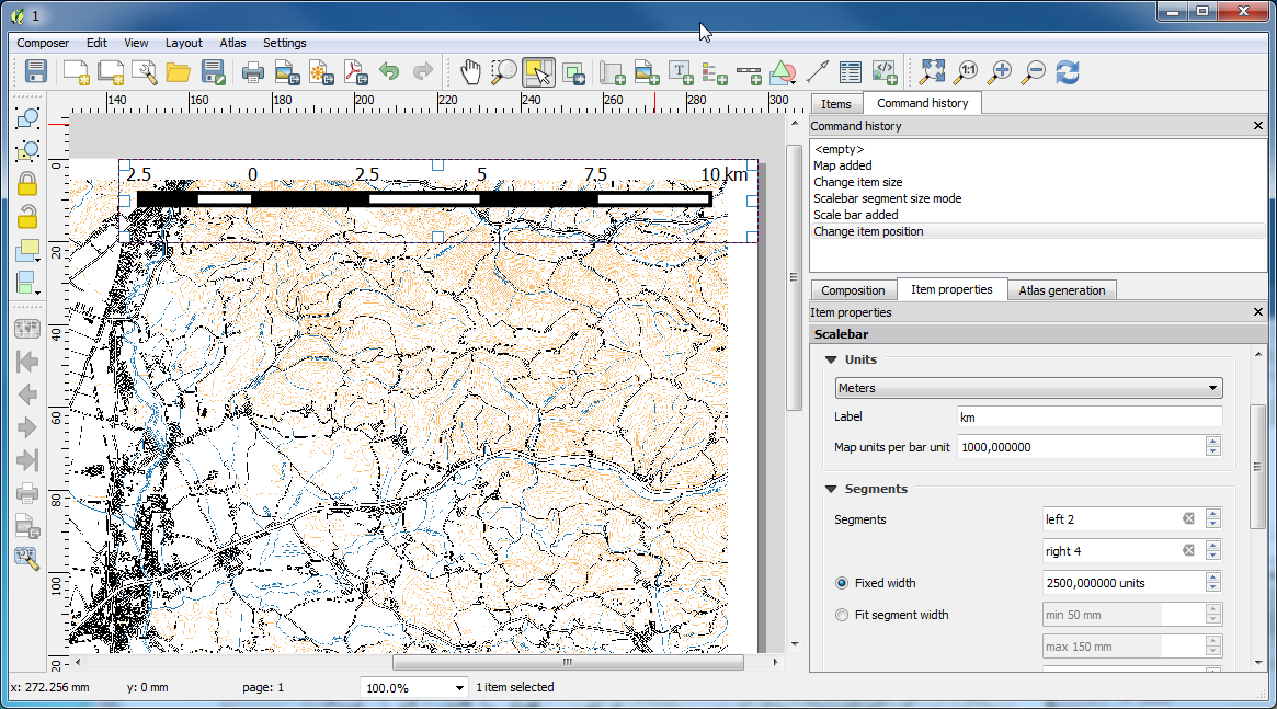
Scalebar in QGis 2.12.0 have very unusual value. Look example in the attached pictures (2.10.1-right, 2.12.0-wrong).
History
#1
 Updated by Paolo Cavallini over 10 years ago
- Subject changed from Scalebare problem in QGis 2.12.0 to Scalebar problem in QGis 2.12.0
#2
 Updated by Harrissou Santanna over 10 years ago
I'm not sure something is wrong there. Just set the same fixed width value as in 2.10 and you'll get same result
#3
 Updated by Joze Stih over 10 years ago
- File Clipboard01.png added
- File Clipboard02.png added
Harrissou Santanna wrote:
I'm not sure something is wrong there. Just set the same fixed width value as in 2.10 and you'll get same result
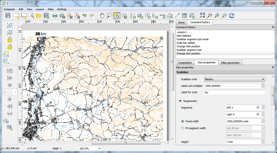
If I set fixed width like in 2.10, I got weary small scalebar (picture Clipboard01). I thought that will be the answer to increase Label unit multiplier on 100000000 (picture Clipboard02), but when I look closer, there was a little difference.
#4
 Updated by Nyall Dawson over 10 years ago
- Status changed from Open to Feedback
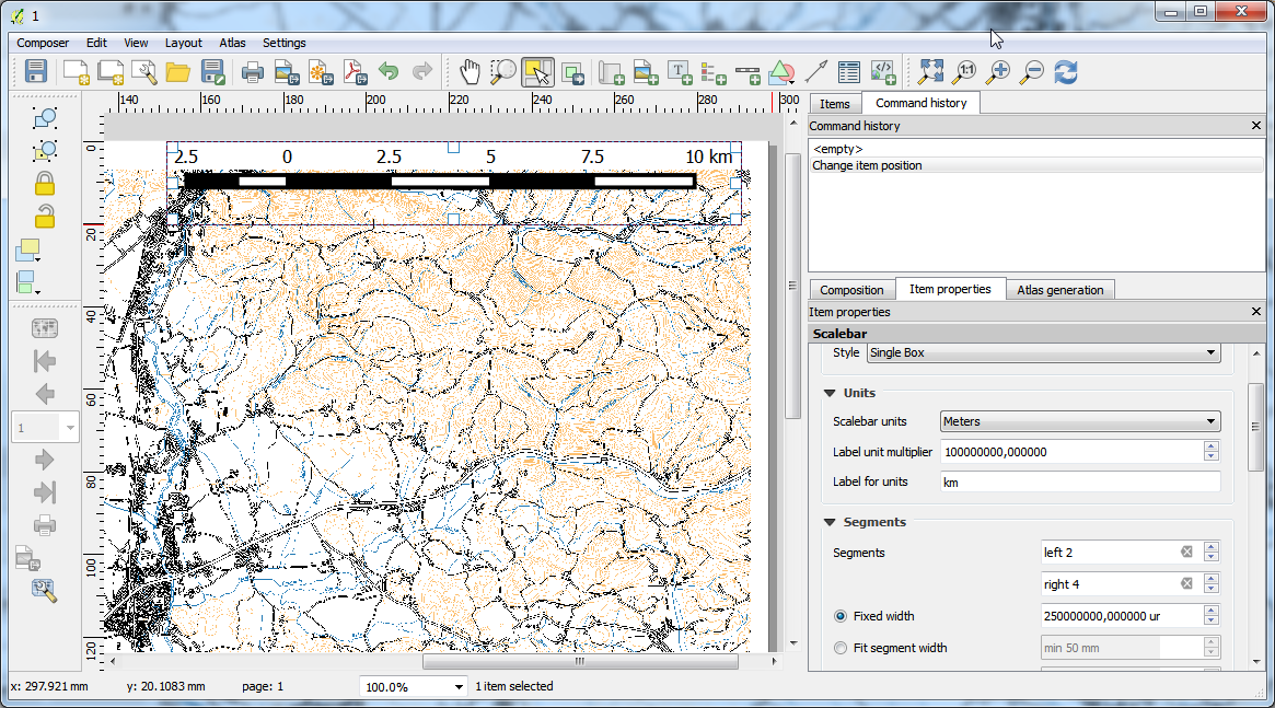
I'm confused - the scalebar in clipboard02.png and QGIS_2.10.1.png look identical to me. What's the problem?
#5
Updated by Joze Stih over 10 years ago
It's look identical, but when I print and compare both, there are little (a few millimetres) difference. Beside it's a strange to use for multiplier from m to km 100.000.000 instead of 1.000.
#6
 Updated by Giovanni Manghi over 10 years ago
- Status changed from Feedback to Open
#7
Updated by Giovanni Manghi about 9 years ago
- Regression? set to No
- Easy fix? set to No
#8
Updated by Giovanni Manghi about 7 years ago
- Resolution set to end of life
- Status changed from Open to Closed
End of life notice: QGIS 2.18 LTR
Source:
http://blog.qgis.org/2019/03/09/end-of-life-notice-qgis-2-18-ltr/
QGIS 3.4 has recently become our new Long Term Release (LTR) version. This is a major step in our history – a long term release version based on the massive updates, library upgrades and improvements that we carried out in the course of the 2.x to 3x upgrade cycle.
We strongly encourage all users who are currently using QGIS 2.18 LTR as their preferred QGIS release to migrate to QGIS 3.4. This new LTR version will receive regular bugfixes for at least one year. It also includes hundreds of new functions, usability improvements, bugfixes, and other goodies. See the relevant changelogs for a good sampling of all the new features that have gone into version 3.4
Most plugins have been either migrated or incorporated into the core QGIS code base.
We strongly discourage the continued use of QGIS 2.18 LTR as it is now officially unsupported, which means we’ll not provide any bug fix releases for it.
You should also note that we intend to close all bug tickets referring to the now obsolete LTR version. Original reporters will receive a notification of the ticket closure and are encouraged to check whether the issue persists in the new LTR, in which case they should reopen the ticket.
If you would like to better understand the QGIS release roadmap, check out our roadmap page! It outlines the schedule for upcoming releases and will help you plan your deployment of QGIS into an operational environment.
The development of QGIS 3.4 LTR has been made possible by the work of hundreds of volunteers, by the investments of companies, professionals, and administrations, and by continuous donations and financial support from many of you. We sincerely thank you all and encourage you to collaborate and support the project even more, for the long term improvement and sustainability of the QGIS project.