Bug report #4472

Single-band Colormap color wrong on one end of color scale.
| Status: | Closed | ||
|---|---|---|---|
| Priority: | Normal | ||
| Assignee: | - | ||
| Category: | Rasters | ||
| Affected QGIS version: | master | Regression?: | No |
| Operating System: | Easy fix?: | No | |
| Pull Request or Patch supplied: | No | Resolution: | end of life |
| Crashes QGIS or corrupts data: | No | Copied to github as #: | 14399 |
Description
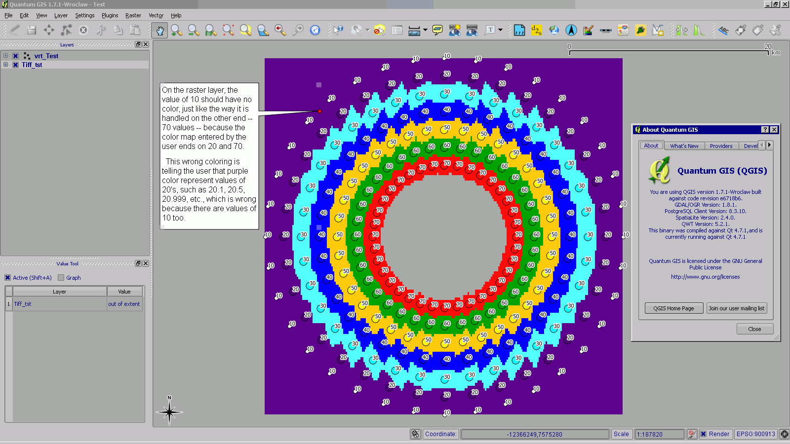
On the raster layer, the value of 10 should have no color, just like the way it is handled on the other end -- 70 values -- because the color map entered by the user ends on 20 and 70.
This wrong coloring is telling the user that purple color represent values of 20's, such as 20.1, 20.5, 20.999, etc., which is wrong because there are values of 10 too.
History
#1
 Updated by Thaddeus - over 14 years ago
- File Test.qgs.png added
#2
Updated by Thaddeus - over 14 years ago
- File D_sample.png added
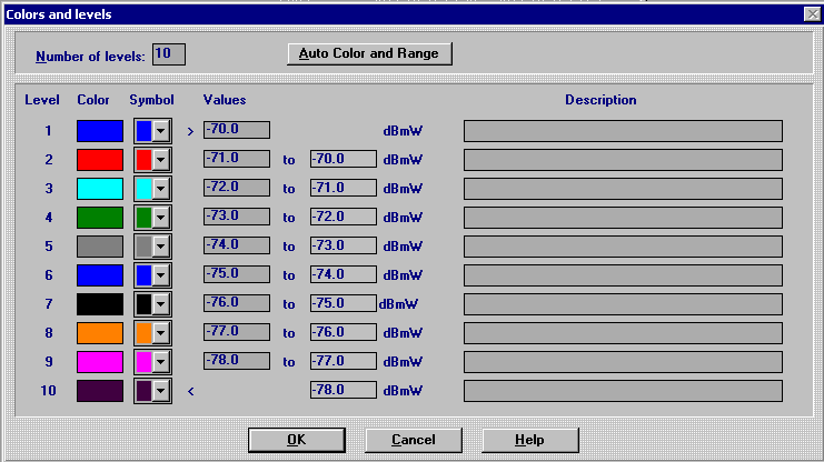
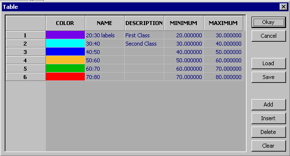
Well, IMHO, this behavior of the color is very confusing and misleading, enough to be called a bug instead of a new feature.
Unless the user is very familiar with the data and calculating the statistics of the band every time he/she loads/test new values/data, big mistakes can be made.
Moreover, some effects can not be realized, such as a mask -- semi-transparent overlay region, say to show tsunami safe areas -- by coloring just the values in the range of 20's (20.1, 20.5, etc, 20.999); for this, one would need to enter two discrete color entries, 20 and 30, resulting in a second unwanted color if a mask is desired (in some cases, when dealing with integer, a work around could be using 100% transparency).
Here are some screenshot:
#3
Updated by Thaddeus - over 14 years ago
- File E_sample.png added
#4
Updated by Thaddeus - over 14 years ago
- File S_sample.png added
#5
 Updated by Giovanni Manghi over 14 years ago
- Target version set to Version 1.7.4
#6
 Updated by Paolo Cavallini about 14 years ago
- Crashes QGIS or corrupts data set to No
- Affected QGIS version set to master
- Target version changed from Version 1.7.4 to Version 1.8.0
#7
Updated by Paolo Cavallini almost 14 years ago
- Target version changed from Version 1.8.0 to Version 2.0.0
#8
Updated by Giovanni Manghi almost 14 years ago
Still confirmed in master.
#9
 Updated by Jürgen Fischer about 12 years ago
- Target version changed from Version 2.0.0 to Future Release - Lower Priority
#10
Updated by Giovanni Manghi about 9 years ago
- Easy fix? set to No
- Regression? set to No
#11
Updated by Giovanni Manghi over 7 years ago
- Status changed from Open to Closed
- Resolution set to end of life
End of life notice: QGIS 2.18 LTR
Source:
http://blog.qgis.org/2019/03/09/end-of-life-notice-qgis-2-18-ltr/