Feature request #3068

Projection information – some handbook or more info in QGIS
| Status: | Feedback | ||
|---|---|---|---|
| Priority: | Low | ||
| Assignee: | |||
| Category: | Documentation and Help | ||
| Pull Request or Patch supplied: | No | Resolution: | |
| Easy fix?: | No | Copied to github as #: | 13128 |
Description
Hi,
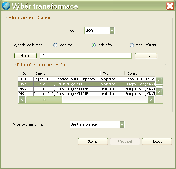
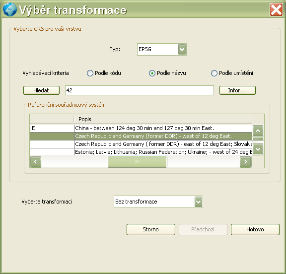
I had a small problem related with projection. I knew, that I should convert my data in WGS84 to S-42 (Pulkovo 1942) for some reason (use with some exotic software) but in QGIS I found a lot of "Pulkovo" projection and did not know which one to use for my area (Czech Republic). I did not have any internet connection available but luckily remembered, that in Kosmo I saw some info about area used for particular projections and later found there which "Pulkovo" is determined for Czech Republic. So this takes me to the idea, that it would be nice to have similar info also in QGIS (could be solved as "bubble" help) or if there is any document or app where is possible to find this information.
The possibility to list projections used for selected area would be also nice, but I cannot have everything I want :-)
What do you think?
PS: as an inspiration I attached two screenshots of Kosmo layer projection dialog where you can see additional information for each projection.
History
#1
 Updated by Giovanni Manghi about 14 years ago
- Target version changed from Version 1.7.0 to Version 1.7.4
#2
Updated by Giovanni Manghi over 13 years ago
- Target version changed from Version 1.7.4 to Version 2.0.0
#3
 Updated by Pirmin Kalberer over 13 years ago
- Target version changed from Version 2.0.0 to Future Release - Nice to have
#4
Updated by Giovanni Manghi over 8 years ago
- Pull Request or Patch supplied set to No
- Easy fix? set to No
#5
 Updated by Harrissou Santanna about 8 years ago
- Description updated (diff)
- Status changed from Open to Feedback
Can we consider that this issue is fixed given:
- the highlight of selected crs extent (see https://github.com/qgis/QGIS/pull/5356)
- and the "assign projection" algorithm (see 61dc8ea28f42a5fed7e37cf5db8297c34b88accf)?
#6
 Updated by Paolo Cavallini almost 8 years ago
Agreed. In addition, a couple of plugins add more infor about projection handling.