Bug report #19626

World map incorrectly drawn when using a different projection than the data source
| Status: | Reopened | ||
|---|---|---|---|
| Priority: | Normal | ||
| Assignee: | - | ||
| Category: | Map Canvas | ||
| Affected QGIS version: | 3.2.1 | Regression?: | No |
| Operating System: | Easy fix?: | No | |
| Pull Request or Patch supplied: | No | Resolution: | duplicate |
| Crashes QGIS or corrupts data: | No | Copied to github as #: | 27453 |
Description
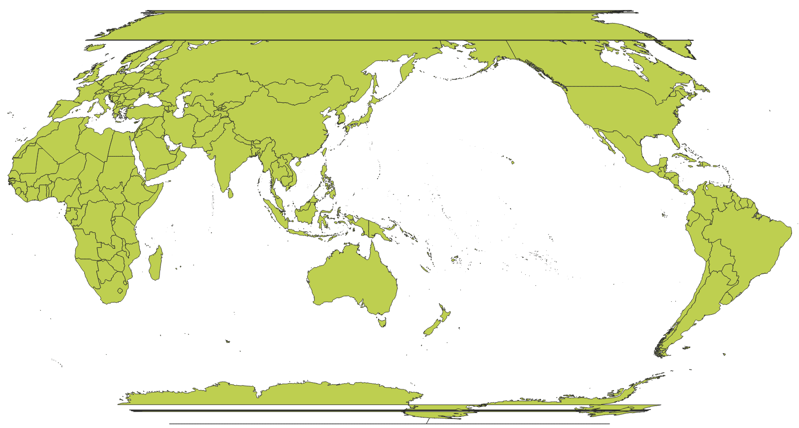
When I use Natural Earth as data source and want to change projection for the project to customized Robinson, the map breaks apart (see attached file).
I use a projection as follows:
Proj4: +proj=robin +lon_0=150dE +x_0=0 +y_0=0 +datum=WGS84 +units=m +no_defs
Hope if it's not a bug. But if it is, I'd like to know if there's a workaround.
Related issues
History
#1
 Updated by Giovanni Manghi almost 8 years ago
- Status changed from Open to Feedback
There are limitations (for features crossing the dateline) when you want to reproject global data. One of the tricks it to generate a 0-360 map instead of a -180/180 one. I believe there is an example on the QGIS manual.
#2
 Updated by Richard Duivenvoorde almost 8 years ago
see #597 including pointers to relevant GRASS solution?
#3
 Updated by 克鲁 黄 almost 8 years ago
Seems that the issue has no elegant solution yet.
As a reminder to other users, please leave this issue open until wrap around works in future releases.
#4
Updated by Giovanni Manghi almost 8 years ago
克鲁 黄 wrote:
Seems that the issue has no elegant solution yet.
As a reminder to other users, please leave this issue open until wrap around works in future releases.
yes, but probably there are similar tickets already open (cannot do a search now). I would appreciate if you could give it a go, so we can eventually close the duplicates.
#5
Updated by 克鲁 黄 almost 8 years ago
All right. If there are duplicates, you're free to close this issue.
#6
Updated by Giovanni Manghi almost 8 years ago
- Status changed from Feedback to Closed
- Resolution set to duplicate
克鲁 黄 wrote:
All right. If there are duplicates, you're free to close this issue.
Duplicate of #13380
#7
 Updated by Andreas Neumann almost 8 years ago
- Related to Bug report #19746: Disappearing -180 / 180 longitude grid lines on certain zoom levels added
#8
Updated by 克鲁 黄 about 7 years ago
- Status changed from Closed to Reopened
I've found that #13380 is closed due to "end of life" of QGIS 2.18 LTR. I will reopen this issue until wrap around works in future releases.