Bug report #13380

reprojection of lat/long lines across 180 in mercator map fails
| Status: | Closed | ||
|---|---|---|---|
| Priority: | Normal | ||
| Assignee: | - | ||
| Category: | Projection Support | ||
| Affected QGIS version: | master | Regression?: | No |
| Operating System: | Easy fix?: | No | |
| Pull Request or Patch supplied: | No | Resolution: | end of life |
| Crashes QGIS or corrupts data: | No | Copied to github as #: | 21432 |
Description
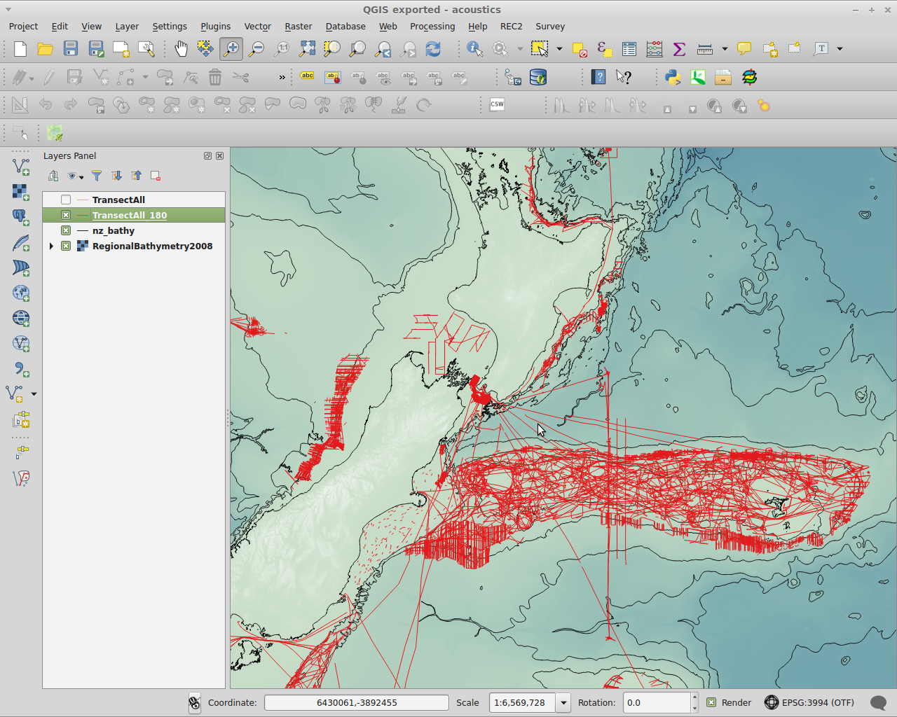
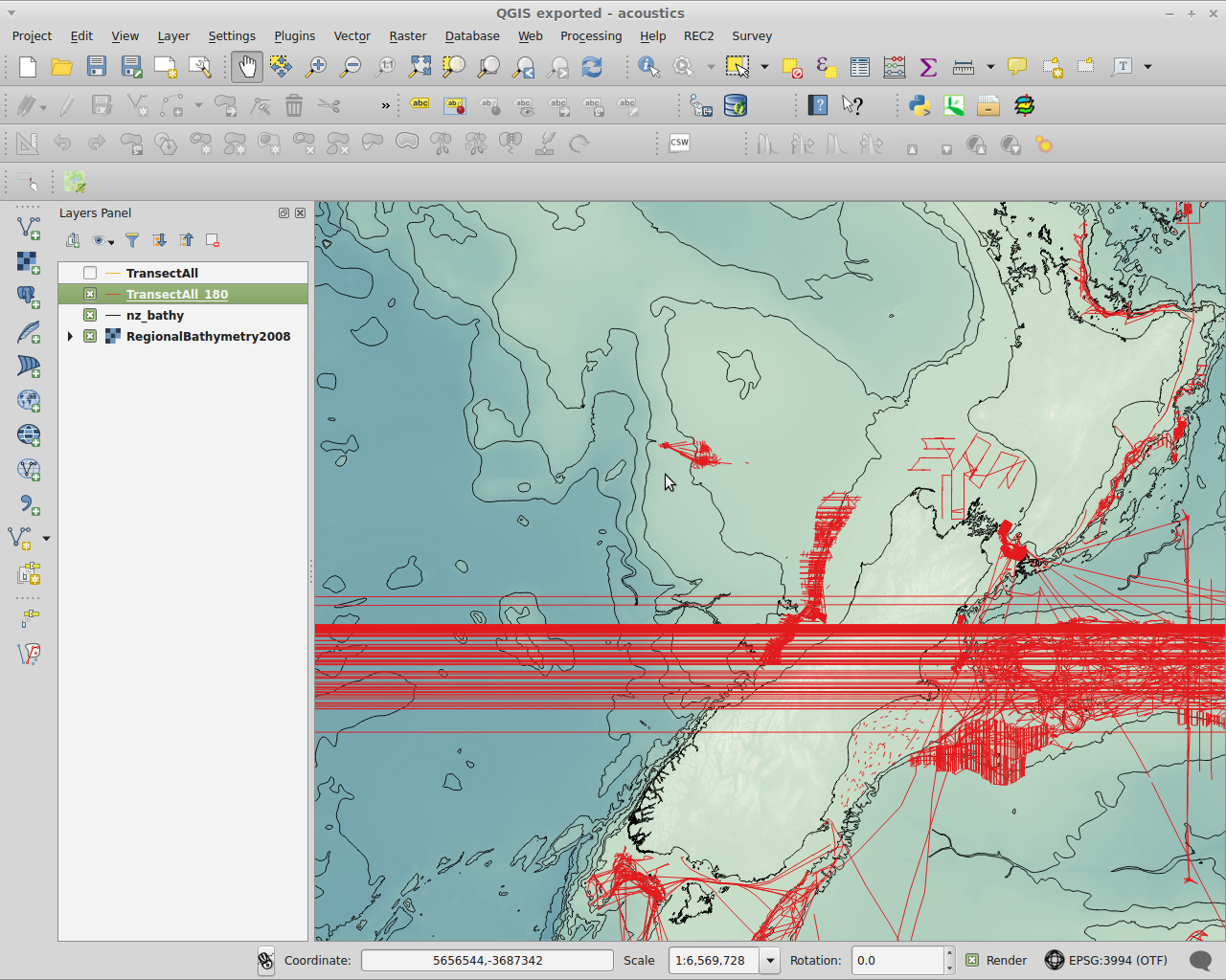
Lines that cross the 180 meridian are wrapped the long way around the world ONLY when the 180 meridian is outside the map extent.
Project CRS=EPSG:3994 (Mercator 41) for maps in the wider New Zealand region.
Optionally open a raster context layer, eg: ftp://ftp.niwa.co.nz/bathymetry/NZBathy_DTM_ascii-grid.zip
Optionally open a vector context layer: eg: ftp://ftp.niwa.co.nz/bathymetry/NZBathy_shape.zip
Open a +-180 EPSG:4326 WFS layer: URL=http://boi.wms.niwa.co.nz/cgi-bin/acoustic_bw layer=TransectAll_180
As long as the 180 meridian is inside the QGIS map canvas extent, lines crossing 180 render correctly. If the map is zoomed or scrolled so that the 180 meridian is outside the canvas extent, the lines wrap across the canvas, essentially traversing the world the long way around.
This appears under several versions of QGIS & appears OS independent.
Related issues
History
#1
 Updated by Brent Wood over 10 years ago
can provide some funding - don't know about all though - without a cost estimate.
#2
 Updated by Jürgen Fischer over 10 years ago
- Category changed from Browser to Projection Support
#3
 Updated by Giovanni Manghi over 10 years ago
- Target version deleted (
Version 2.10)
#4
 Updated by Saber Razmjooei over 9 years ago
- Status changed from Open to Feedback
The WFS is down. Could you try with the latest master and report back?
#5
Updated by Giovanni Manghi over 9 years ago
- OS version deleted (
Mint 17.1/Win7) - Operating System deleted (
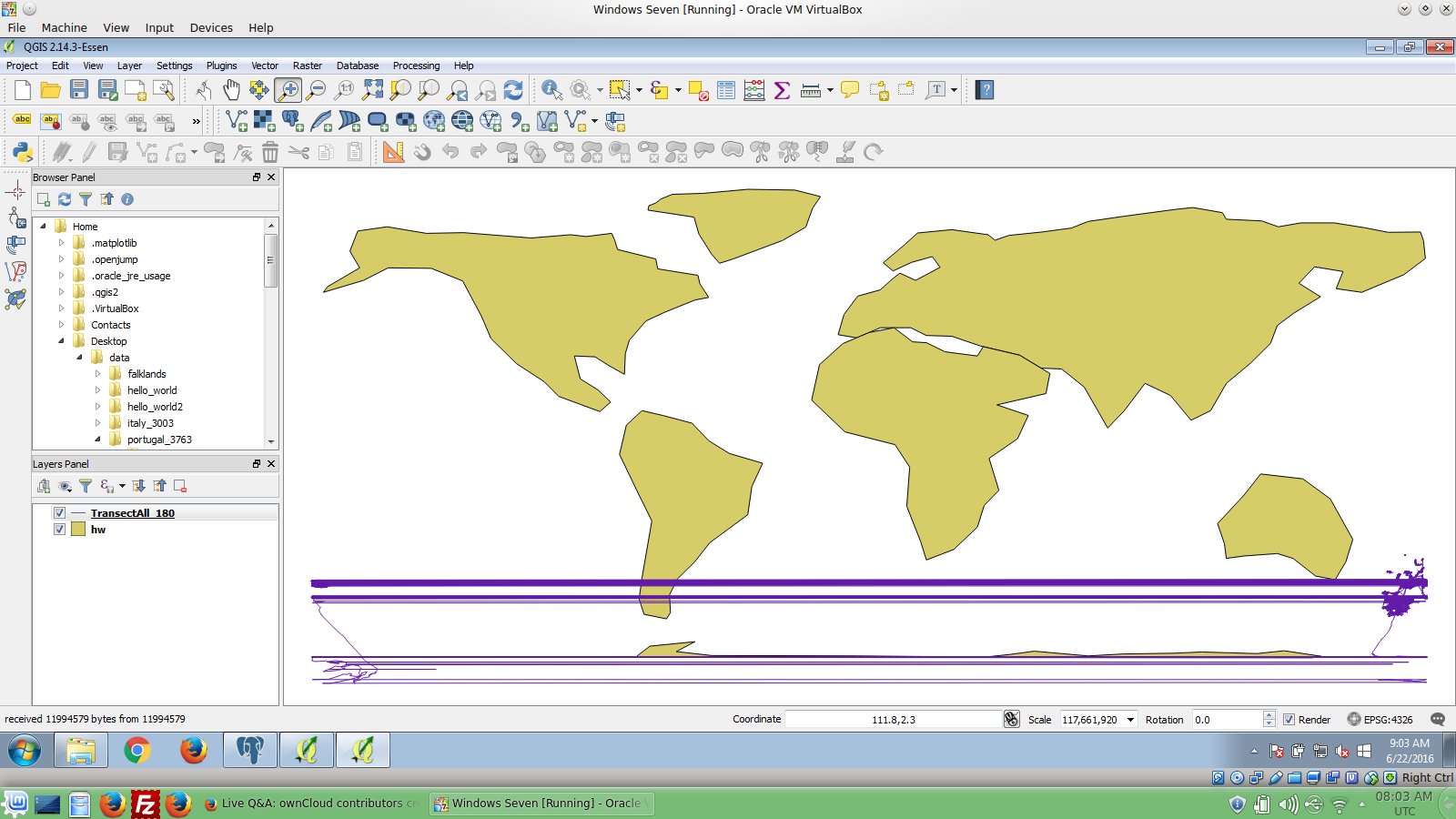
Linux/Windows) - File master.jpg added
- File 214.jpg added
The issue is old, I wrote this paragraph
a looong ago.
Anyway see the attached screenshots (master and 2.14.3), now it seems there is another problem in the WFS client in master, if confirmed a new regression ticket must be filed. Please leave feedback.
#6
Updated by Giovanni Manghi about 9 years ago
- Priority changed from High to Normal
- Status changed from Feedback to Open
Setting it open because there is anyway a lot of room for improvement... is anyway something affects qgis since forever I think.
#7
Updated by Giovanni Manghi almost 9 years ago
- Easy fix? set to No
- Regression? set to No
#8
Updated by Jürgen Fischer over 7 years ago
- Duplicated by Bug report #18323: Multi-part Polygon is not mapped with shortest segments added
#9
 Updated by Andreas Neumann over 7 years ago
- Related to Bug report #19746: Disappearing -180 / 180 longitude grid lines on certain zoom levels added
#10
Updated by Giovanni Manghi almost 7 years ago
- Resolution set to end of life
- Status changed from Open to Closed
End of life notice: QGIS 2.18 LTR
Source:
http://blog.qgis.org/2019/03/09/end-of-life-notice-qgis-2-18-ltr/