Bug report #18881

QGIS cannot recognise CRS from ESRI wkt on ArcGIS Feature Server
| Status: | Closed | ||
|---|---|---|---|
| Priority: | Normal | ||
| Assignee: | - | ||
| Category: | Projection Support | ||
| Affected QGIS version: | 3.0.2 | Regression?: | No |
| Operating System: | Ubuntu 18.04 LTS | Easy fix?: | No |
| Pull Request or Patch supplied: | Yes | Resolution: | |
| Crashes QGIS or corrupts data: | No | Copied to github as #: | 26713 |
Description
I am using ArcGisFeatureServer to read Feature Layers from an ArcGIS server url:
https://roadworks.gov.je/arcgis/rest/services/JSW_With_Beach_Access/MapServer
All of the layers on this server use a CRS defined by ESRI wkt: PROJCS["NewJTM",GEOGCS["GCS_ETRF_1989",DATUM["D_ETRF_1989",SPHEROID["WGS_1984",6378137.0,298.257223563]],PRIMEM["Greenwich",0.0],UNIT["Degree",0.0174532925199433]],PROJECTION["Transverse_Mercator"],PARAMETER["False_Easting",40000.0],PARAMETER["False_Northing",70000.0],PARAMETER["Central_Meridian",-2.135],PARAMETER["Scale_Factor",0.9999999],PARAMETER["Latitude_Of_Origin",49.225],UNIT["Meter",1.0]]
This is the wkt for EPSG:3109, ETRS89 / Jersey Transverse Mercator see: http://prj2epsg.org/epsg/3109
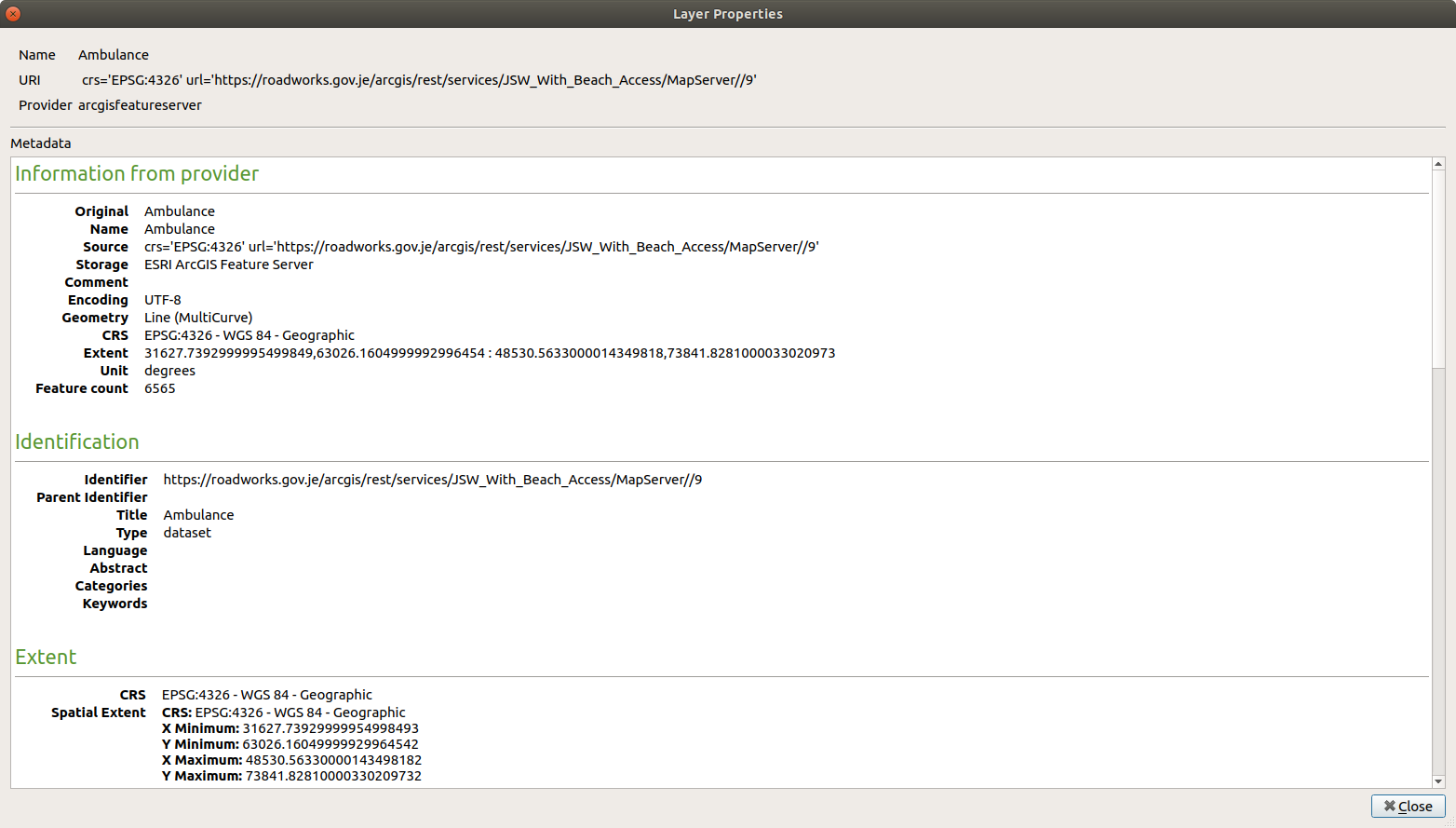
However, after adding the server, if I choose a layer - e.g. layer 'Ambulance' - the crs in the properties has been read in as EPSG:4326. Please refer to attached screenshot.
When adding such a layer to my project (whose crs is also EPSG:3109) I get the following Warning in the CRS tab of the Log Messages panel: "WARNING Transform error caught: Could not transform bounding box to target CRS". The layer is not added to my project.
Steps to reproduce as above. No known workaround, but interestingly if I choose a layer whose Geomerty Type is esriGeometryPoint (e.g. layer 8) I get the same warning, but the layer is added.
Many thanks.
Associated revisions
[afs] Fix handling of custom projections
Don't treat all unknown projections as WGS84
Fixes #18881
(cherry-picked from ea38c732)
History
#1
 Updated by Bruce Steedman about 8 years ago
Update: I found a workaround; if I add the layer, edit the properties/Source and change the Coordinate reference system to the correct one (EPSG:3109) and apply, the layer is visible. Of course if I remove the layer and re-add it, the wrong crs is used again.
Also, I found an upstream GDAL bug which may be related: https://trac.osgeo.org/gdal/ticket/4345. It has a milestone of GDAL v2.3.0, so may be included in GDAL 2.3.0beta1 which is on GitHub since 20th April 2018: https://github.com/OSGeo/gdal/releases/tag/v2.3.0beta1. I am not able to test this until I figure out how to build it from source & build QGIS with this version of GDAL. In the meantime I will try and fork GDAL and add the wkt for EPSG:3109 into a unit test to see if it passes.
#2
 Updated by Nyall Dawson about 8 years ago
- Pull Request or Patch supplied changed from No to Yes
- Status changed from Open to In Progress
#3
Updated by Nyall Dawson about 8 years ago
- % Done changed from 0 to 100
- Status changed from In Progress to Closed
Applied in changeset qgis|ea38c7322bedbd9b37342de8f48c6700931df50e.