Bug report #17822

Wrong labels in grids of the designer (CRS changed)
| Status: | Closed | ||
|---|---|---|---|
| Priority: | High | ||
| Assignee: | - | ||
| Category: | Map Composer/Printing | ||
| Affected QGIS version: | 2.18.15 | Regression?: | No |
| Operating System: | Windows 8 | Easy fix?: | No |
| Pull Request or Patch supplied: | No | Resolution: | end of life |
| Crashes QGIS or corrupts data: | No | Copied to github as #: | 25718 |
Description
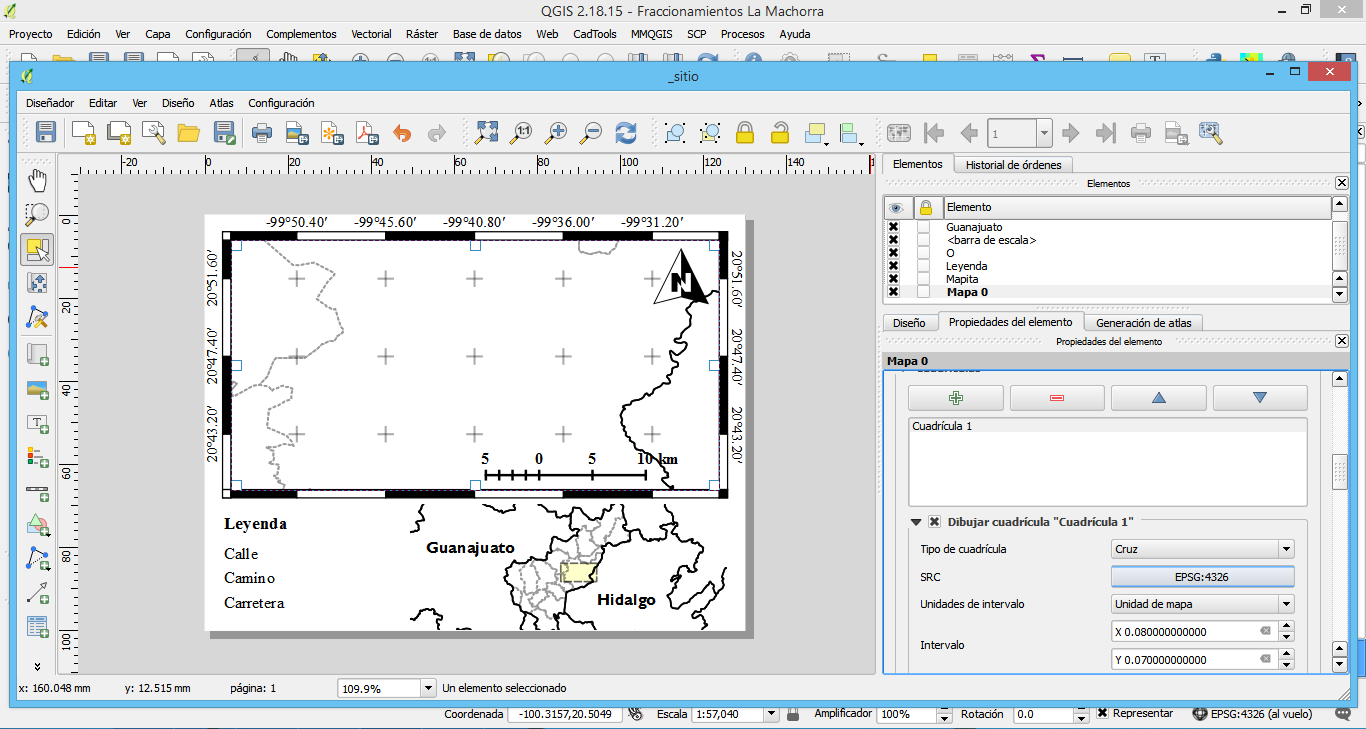
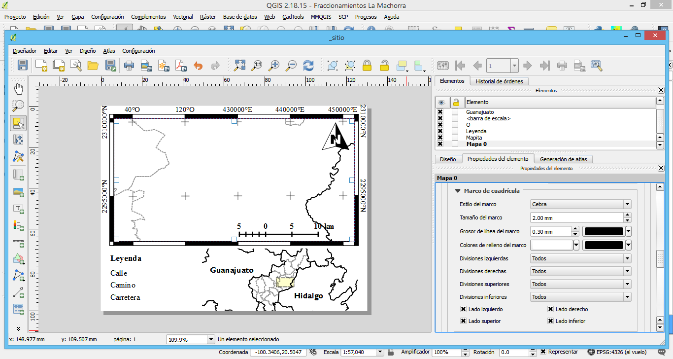
I found this bug working with a project based on a WGS84 CRS. When I started the designer and put a grid with a WGS84-UTM 14N CRS I don't see all the labels with the correct system, there are some coordinates with wrong numbers (in the X axis mainly). I watched this problem since the 2.14 version.
History
#1
 Updated by Nyall Dawson over 8 years ago
- Status changed from Open to Feedback
Can you attach a project which demonstrates this?
#2
 Updated by Luis Olivares over 8 years ago
- File Example.rar added
For sure. I attach you a project with a WGS 84 CRS for the whole project and a layout with the output CRS changed to UTM 14N.
#3
 Updated by Giovanni Manghi over 8 years ago
Please give also a try to QGIS 3 and then report back.
#4
Updated by Giovanni Manghi almost 8 years ago
- Status changed from Feedback to Open
#5
 Updated by Jürgen Fischer over 7 years ago
- Status changed from Open to Feedback
Please test with QGIS 3.4 - QGIS 2.18 reached it's end of life.
#6
Updated by Giovanni Manghi over 7 years ago
- Resolution set to end of life
- Status changed from Feedback to Closed
End of life notice: QGIS 2.18 LTR
Source:
http://blog.qgis.org/2019/03/09/end-of-life-notice-qgis-2-18-ltr/
QGIS 3.4 has recently become our new Long Term Release (LTR) version. This is a major step in our history – a long term release version based on the massive updates, library upgrades and improvements that we carried out in the course of the 2.x to 3x upgrade cycle.
We strongly encourage all users who are currently using QGIS 2.18 LTR as their preferred QGIS release to migrate to QGIS 3.4. This new LTR version will receive regular bugfixes for at least one year. It also includes hundreds of new functions, usability improvements, bugfixes, and other goodies. See the relevant changelogs for a good sampling of all the new features that have gone into version 3.4
Most plugins have been either migrated or incorporated into the core QGIS code base.
We strongly discourage the continued use of QGIS 2.18 LTR as it is now officially unsupported, which means we’ll not provide any bug fix releases for it.
You should also note that we intend to close all bug tickets referring to the now obsolete LTR version. Original reporters will receive a notification of the ticket closure and are encouraged to check whether the issue persists in the new LTR, in which case they should reopen the ticket.
If you would like to better understand the QGIS release roadmap, check out our roadmap page! It outlines the schedule for upcoming releases and will help you plan your deployment of QGIS into an operational environment.
The development of QGIS 3.4 LTR has been made possible by the work of hundreds of volunteers, by the investments of companies, professionals, and administrations, and by continuous donations and financial support from many of you. We sincerely thank you all and encourage you to collaborate and support the project even more, for the long term improvement and sustainability of the QGIS project.