Bug report #17498

WMS GetFeatureInfo requests not working
| Status: | Closed | ||
|---|---|---|---|
| Priority: | High | ||
| Assignee: | |||
| Category: | Web Services clients/WMS | ||
| Affected QGIS version: | master | Regression?: | Yes |
| Operating System: | Easy fix?: | No | |
| Pull Request or Patch supplied: | No | Resolution: | fixed/implemented |
| Crashes QGIS or corrupts data: | No | Copied to github as #: | 25395 |
Description
Trying to do a WMS GetFeatureInfo request results in an error such as:
msWMSFeatureInfo(): WMS server error. Invalid I/J values(on a local instance of MapServer)or
Parameter X(or Y,I,J) out of scope(on a remote ArcGIS service)With a request like:
hydrogeology/MapServer/WmsServer?SERVICE=WMS&VERSION=1.3.0&REQUEST=GetFeatureInfo&BBOX=-1.86174381807687928,52.1834395954103627,-0.14115908462290472,53.72364044551835605&CRS=CRS:84&WIDTH=868&HEIGHT=777&LAYERS=Hydrogeology&STYLES=&FORMAT=image/png&QUERY_LAYERS=Hydrogeology&INFO_FORMAT=text/html&I=939&J=27102)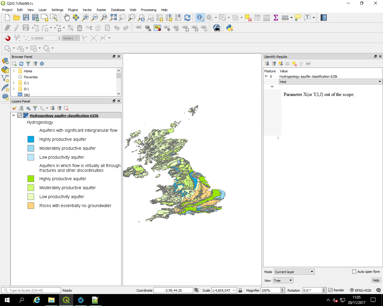
Associated revisions
[bugfix][wms] Fix GetFeatureInfo
Fixes #17498 WMS GetFeatureInfo requests not working
Use the right variable instead of an
unitialized one ( followup b119744 )
History
#1
 Updated by James Passmore about 8 years ago
Looking at the local logs, requests to the MapServer instance that result in the error are like:
/cgi-bin/exemplars/BGS_Bedrock_and_Superficial_Geology/wms?SERVICE=WMS&VERSION=1.3.0&REQUEST=GetFeatureInfo&BBOX=53.33980444241124275,-2.24691918108755129,54.12614968139177307,-1.45132282164842641&CRS=EPSG:4326&WIDTH=516&HEIGHT=510&LAYERS=GBR_BGS_625k_SLS&STYLES=&FORMAT=image/png&QUERY_LAYERS=GBR_BGS_625k_SLS&INFO_FORMAT=text/html&I=1457&J=35104
#2
 Updated by Giovanni Manghi about 8 years ago
- Status changed from Open to Feedback
Can you provide the full URL of the endpoint? what is the endpoint? mapserver? geoserver? else?
#3
Updated by Giovanni Manghi about 8 years ago
Does the same endpoint work as expected on 2.18.14?
#4
Updated by James Passmore about 8 years ago
The following MapServer WMS has the issue on: QGIS version 2.99.0-Master QGIS code revision af5b2a750a
http://ogc.bgs.ac.uk/cgi-bin/TFL-PSI/ows?
The same service works on: QGIS version 2.18.3 QGIS code revision 77b8c3d
Here's an example GFI that works on the service:
The following ArcGIS service is the service in the report:
https://map.bgs.ac.uk/arcgis/services/GeoIndex_Onshore/hydrogeology/MapServer/WmsServer?
GFI works on: QGIS version 2.18.3 QGIS code revision 77b8c3d
The following GeoServer service doesn't work on: QGIS version 2.99.0-Master QGIS code revision af5b2a750a
http://ogc.bgs.ac.uk:80/digmap625k_gsml_insp_gs/ows?
It works as expected on: QGIS version 2.18.3 QGIS code revision 77b8c3d
#5
Updated by Giovanni Manghi about 8 years ago
- Priority changed from Normal to High
- Regression? changed from No to Yes
- Operating System deleted (
Windows Server 2016) - Status changed from Feedback to Open
#6
 Updated by Alessandro Pasotti about 8 years ago
- Assignee set to Alessandro Pasotti
#7 Updated by Anonymous about 8 years ago
- Status changed from Open to Closed
- % Done changed from 0 to 100
Applied in changeset qgis|94a1e68a25199e455bc6126ed02c55ff250defa9.
#8
Updated by Giovanni Manghi about 8 years ago
- Resolution set to fixed/implemented