Bug report #17272

QGIS shows different geometry type in layer 'information' then ogrinfo
| Status: | Closed | ||
|---|---|---|---|
| Priority: | Normal | ||
| Assignee: | - | ||
| Category: | Data Provider/OGR | ||
| Affected QGIS version: | master | Regression?: | No |
| Operating System: | Easy fix?: | No | |
| Pull Request or Patch supplied: | No | Resolution: | |
| Crashes QGIS or corrupts data: | No | Copied to github as #: | 25170 |
Description
Now that we go 3D...
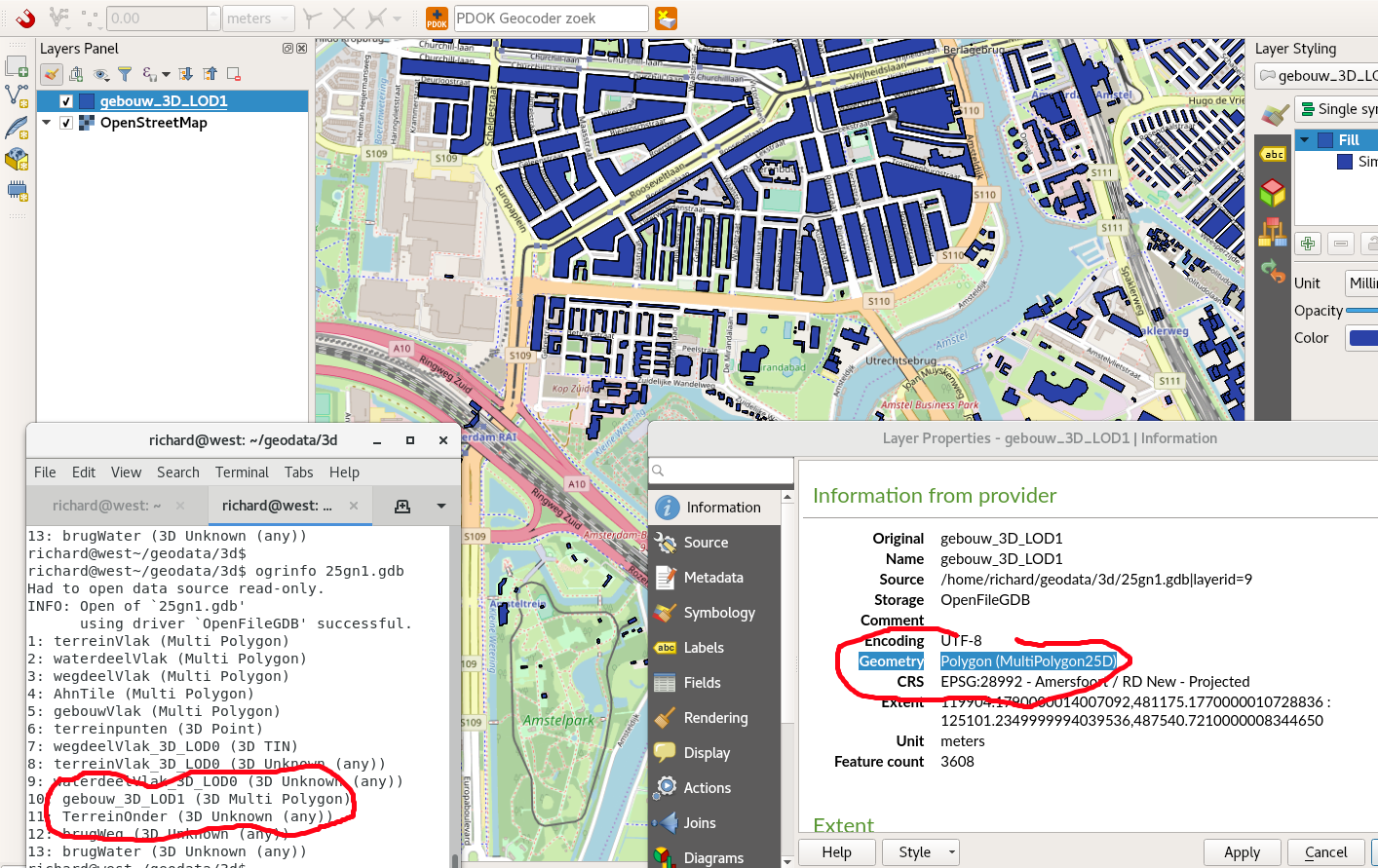
Loading a 3D polygon layer, for example this GDB:
http://services.arcgisonline.nl/3D_kaart_NL/25gn1.zip
The provider (ogrinfo reports the geometries as:
3D Multi Polygon
While QGIS in it's Layer Properties/Information panel shows them as:
Geometry Polygon (MultiPolygon25D)
See screen shot..
From Martin I understand there are 'different' types of 3D:
https://github.com/qgis/QGIS-Enhancement-Proposals/issues/105#issuecomment-336051394
But at least QGIS should show I think the right result?
Screenie attached
History
#1
 Updated by Even Rouault about 8 years ago
This is just a terminology difference. 25D = 2.5D. Probably that the "3D MultiPolygon" in ogrinfo is not appropriate, since a multipolygon is supposed to be a planar thing, so at best 2.5D. Perhaps MultiPolygonZ would be a more neutal terminology. The only real 3D geometry is a PolyhedralSurface (not sure if that's handled by QGIS yet)
#2
 Updated by Richard Duivenvoorde about 8 years ago
Feel free to close this.
My point is just that I think 'notable geofoss tools' should use the same (and preferably professionally right) names and definitions for everything.
And I'm aware that this is more difficult with a widespread/anarchitic bunch of coders (compared to a dictotarial multinational), but I think we at least should try :-)
@even: is it worth starting a discussion about this (both on GDAL an QGIS lists?) so we can hopefully come to a shared (documented) definition?
Else: just close it.
#3
 Updated by Giovanni Manghi almost 7 years ago
- Status changed from Open to Feedback
Please check if this issue is still valid on QGIS 3.4.5 or 3.6.
#4
Updated by Richard Duivenvoorde almost 7 years ago
- Status changed from Feedback to Closed