Bug report #14499

GRASS GIS 7 CRS issue
| Status: | Closed | ||
|---|---|---|---|
| Priority: | Normal | ||
| Assignee: | - | ||
| Category: | Processing/GRASS | ||
| Affected QGIS version: | 2.14.0 | Regression?: | No |
| Operating System: | Windows | Easy fix?: | No |
| Pull Request or Patch supplied: | No | Resolution: | duplicate |
| Crashes QGIS or corrupts data: | No | Copied to github as #: | 22474 |
Description
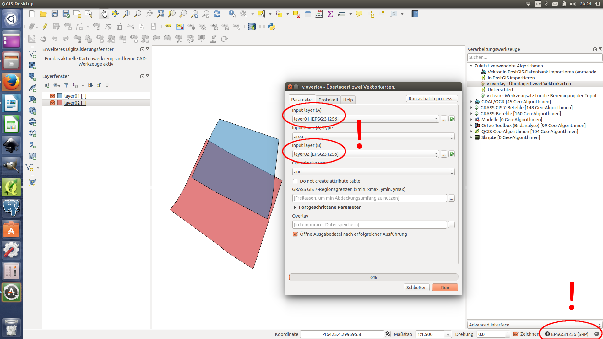
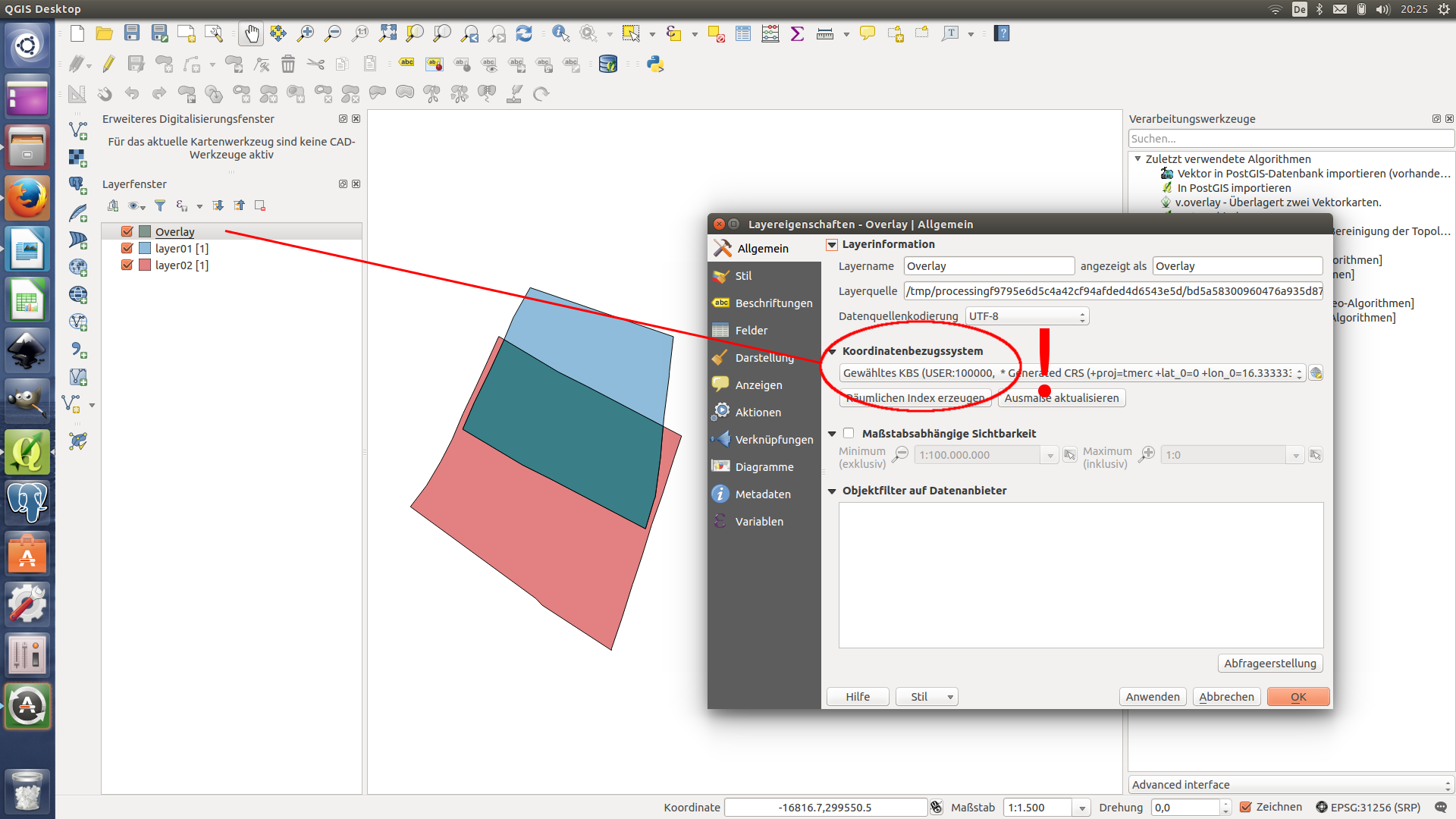
In my case the output layer of a GRASS GIS 7 command always has a generated CRS:
+proj=tmerc +lat_0=0 +lon_0=16.33333333333333 +k=1 +x_0=0 +y_0=-5000000 +ellps=bessel +units=m +no_defs
The CRS of the project and the input layers is MGI / Austria GK East (+proj=tmerc +lat_0=0 +lon_0=16.33333333333333 +k=1 +x_0=0 +y_0=-5000000 +ellps=bessel +towgs84=577.326,90.129,463.919,5.137,1.474,5.297,2.4232 +units=m +no_defs).
WGS 84 (4326) input layers seem to work properly. I haven’t tested other CRS so far.
Related issues
History
#1
 Updated by R. R. about 10 years ago
- Assignee deleted (
Victor Olaya)
#2
 Updated by Maximilian Krambach about 10 years ago
From the prj files of the shapes:
Created in QGIS:
PROJCS["MGI_Austria_GK_East",GEOGCS["GCS_MGI",DATUM["D_MGI",SPHEROID["Bessel_1841",6377397.155,299.1528128]],PRIMEM["Greenwich",0],UNIT["Degree",...
Output of v.clean via QGIS-toolbox
PROJCS["Transverse_Mercator",GEOGCS["GCS_bessel",DATUM["D_unknown",SPHEROID["Bessel_1841",6377397.155,299.1528128]],PRIMEM["Greenwich",0],UNIT["Degree",...
Imported into a new grass project; exported again
PROJCS["Transverse_Mercator",GEOGCS["GCS_bessel",DATUM["D_Militar_Geographische_Institut",SPHEROID["Bessel_1841",6377397.155,299.1528128]],PRIMEM["Greenwich",0],UNIT["Degree"...
(... is identical)
So the names of the CRS and the Datum differ, but the rest seems okay.
#3
 Updated by Paolo Cavallini about 10 years ago
- OS version set to 10
- Operating System set to Windows
So apparently +towgs params are stripped. I confirm this for Windows, whereas on Debian it works fine (EPSG:3003 in input results in 3003 in output).
#4
 Updated by Giovanni Manghi about 10 years ago
- Resolution set to duplicate
- Status changed from Open to Closed
duplicate of #11884
#5
 Updated by Stefan Blumentrath over 9 years ago
My guess is that the issue is related to this one:
https://trac.osgeo.org/grass/ticket/3048
(GRASS does not write AUTHORITY parameter (the EPSG code) to GeoTIFFs, thus QGIS makes a guess where it takes the first matching CRS (the ID number of the assigned EPSG code is lower than the original), I presume...).