Bug report #13536

GeoTIFF rendering issues with GDAL >2.0
| Status: | Closed | ||
|---|---|---|---|
| Priority: | Normal | ||
| Assignee: | - | ||
| Category: | Rasters | ||
| Affected QGIS version: | master | Regression?: | No |
| Operating System: | Easy fix?: | No | |
| Pull Request or Patch supplied: | No | Resolution: | |
| Crashes QGIS or corrupts data: | No | Copied to github as #: | 21578 |
Description
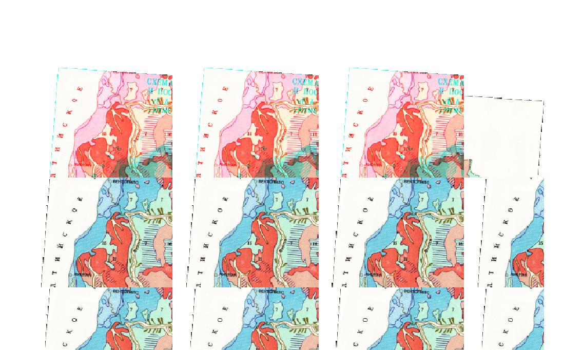
I have a GeoTIFF file that for some reason is rendered by multiple tiles of same content when zoomed out (see attachment). Zooming in fixes the issue.
For some reason it happens only with GDAL 2.0.0 or 2.0.1, but 1.11.x is not affected. It could be also a bug in GDAL itself although GRASS GIS 7.1 is not affected by this issue.
QGIS versija 2.11.0-Master
QGIS koda revīzija a213b03
Kompilēts priekš Qt 4.8.7
Darbina ar Qt 4.8.7
Compiled against GDAL/OGR 2.0.1
Running against GDAL/OGR 2.0.1
Compiled against GEOS 3.4.2-CAPI-1.8.2
Running against GEOS 3.4.2-CAPI-1.8.2 r3921
PostgreSQL klienta versija 9.3.4
SpatiaLite versija 3.0.1
QWT versija 5.2.3
PROJ.4 versija 480
QScintilla2 Version 2.9
History
#1
 Updated by Even Rouault over 10 years ago
- Status changed from Open to Closed
This was a GDAL problem. Fixed per https://trac.osgeo.org/gdal/ticket/6308 (will be in GDAL 2.0.2). Surprising GRASS wasn't affected. You're lucky I found this ticket by chance, so next time you suspect a GDAL issue, do not hesitate to report on GDAL Trac.
#2
 Updated by marisn - over 10 years ago
rouault - wrote:
This was a GDAL problem. Fixed per https://trac.osgeo.org/gdal/ticket/6308 (will be in GDAL 2.0.2). Surprising GRASS wasn't affected. You're lucky I found this ticket by chance, so next time you suspect a GDAL issue, do not hesitate to report on GDAL Trac.
Thanks for rising it up to a proper place. From an end user perspective it is hard to understand if it is QGIS misuse of GDAL or problem with GDAL itself.