Bug report #9643

map overview extend broken under qgis master (2.3)
| Status: | Closed | ||
|---|---|---|---|
| Priority: | Normal | ||
| Assignee: | |||
| Category: | - | ||
| Affected QGIS version: | master | Regression?: | No |
| Operating System: | Easy fix?: | No | |
| Pull Request or Patch supplied: | No | Resolution: | |
| Crashes QGIS or corrupts data: | No | Copied to github as #: | 18215 |
Description
Under qgis master (2.3), the map overview extend regressed:
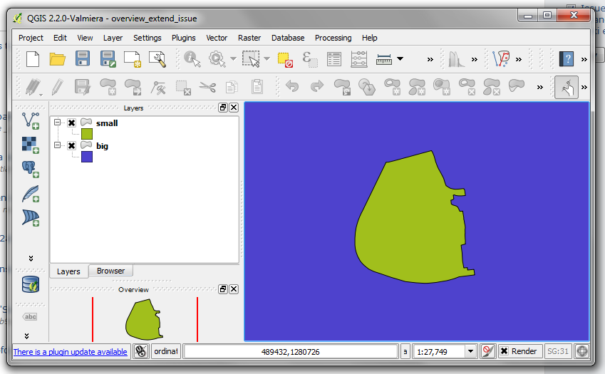
- Under qgis 2.2, the map overview extend is confined to only the layers that have activated the '[x] show in overview' option. (see overview-extend-qgis2.2-ok.png)
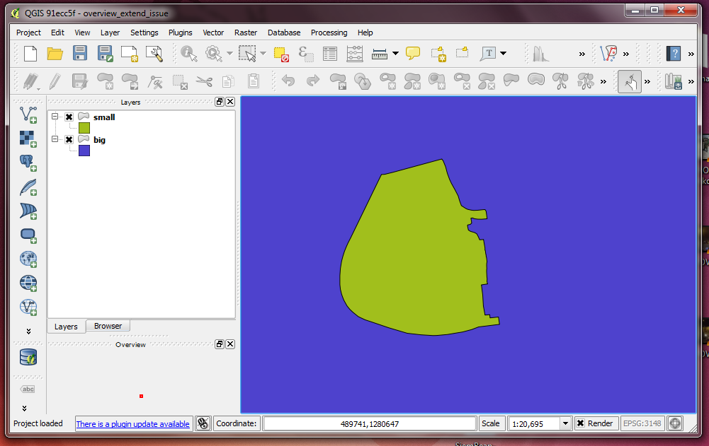
- Under qgis master (2.3), the map overview extend extends to cover all layers, even the ones that do not show in overview. (see overview-extend-qgis2.3-broken.png)
I've attached a test project which demonstrates this quite well. Flagging this as a multi-thread rendering issue.
Associated revisions
Fix #9643 (overview extent broken)
History
#1
 Updated by Martin Dobias over 12 years ago
Hmm... actually the current behavior seems like the correct one to me :-) and previous seems wrong.
Like this you can always see where is your map canvas view is within the project extent - even if no layers have been explicitly added to the overview.
#2
 Updated by Mathieu Pellerin - nIRV over 12 years ago
Martin, QGIS' original behavior was to simply show project extend, but it was changed in late 2012 to show only extend of visible layers in overview, see this commmit: #2613cf6ad5ec0afcb033e59e60af89384e234f99#diff-517f2b5299b4c3032c5d22025594f0e5
In my uses of the overview map, I find the 2012 change a great improvement. A project extend can very often go beyond the extend of interest. For e.g., I often produce national maps with a background layer that shows regional political boundaries as well as sea boundaries. That background layer extends way beyond the area of interest and is there to add partial neighbor context when exporting maps.
#3
Updated by Martin Dobias over 12 years ago
- Status changed from Open to Closed
Fixed in changeset 29e9272285e1196602d535476b7fd58e2b3f0f13.
#4
Updated by Martin Dobias over 12 years ago
Updated so that overview uses extent of layers visible in overview. If no layers are visible in overview, it would use full extent. win-win :-)
#5
Updated by Mathieu Pellerin - nIRV over 12 years ago
Excellent.