Bug report #6786

Poor handling of float nodata value
| Status: | Closed | ||
|---|---|---|---|
| Priority: | Normal | ||
| Assignee: | - | ||
| Category: | Rasters | ||
| Affected QGIS version: | master | Regression?: | No |
| Operating System: | ubuntu | Easy fix?: | No |
| Pull Request or Patch supplied: | No | Resolution: | wontfix |
| Crashes QGIS or corrupts data: | No | Copied to github as #: | 15935 |
Description
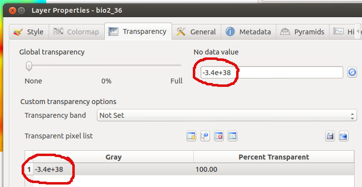
I am trying to process some bioclimatic raster files, such as can be downloaded from http://www.worldclim.org/current (bioclim set). They seem to have nodata values set to -3.4e+38 according to QGIS (looking at the output of gdalinfo, it's -3.39999999999999996e+38).
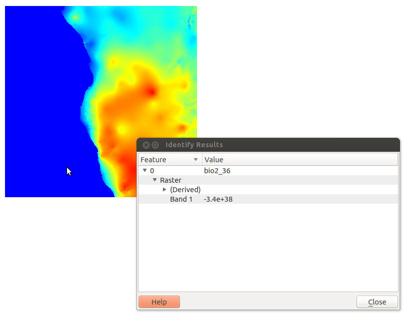
QGIS picks up the nodata value (attached nodata_dialog.jpg), but does not apply it. In the layer styling, there's an entry for -3.4e+38 set to 100% transparent, but it still displays such values, even though the "Identify features" picker shows them as having value -3.4e+38 (nodata.jpg).
A workaround was to first use gdalwarp to change the nodata value to an integer, or to use gdal_translate to convert from a float to integer raster file. See discussion at http://gis.stackexchange.com/questions/42555/what-to-do-with-3-4e38-nodata-values/ for more.
History
#1
 Updated by Giovanni Manghi about 13 years ago
- Status changed from Open to Feedback
rasters have been overhauled in qgis master, have you tested it?
#2
 Updated by Jürgen Fischer almost 13 years ago
- Resolution set to wontfix
- Status changed from Feedback to Closed
closing for the lack of feedback