Bug report #4282

Wrong map zooming when using the "Attribute Table" zoom tool.
| Status: | Closed | ||
|---|---|---|---|
| Priority: | Normal | ||
| Assignee: | - | ||
| Category: | - | ||
| Affected QGIS version: | Regression?: | No | |
| Operating System: | Easy fix?: | No | |
| Pull Request or Patch supplied: | No | Resolution: | fixed |
| Crashes QGIS or corrupts data: | Copied to github as #: | 14221 |
Description
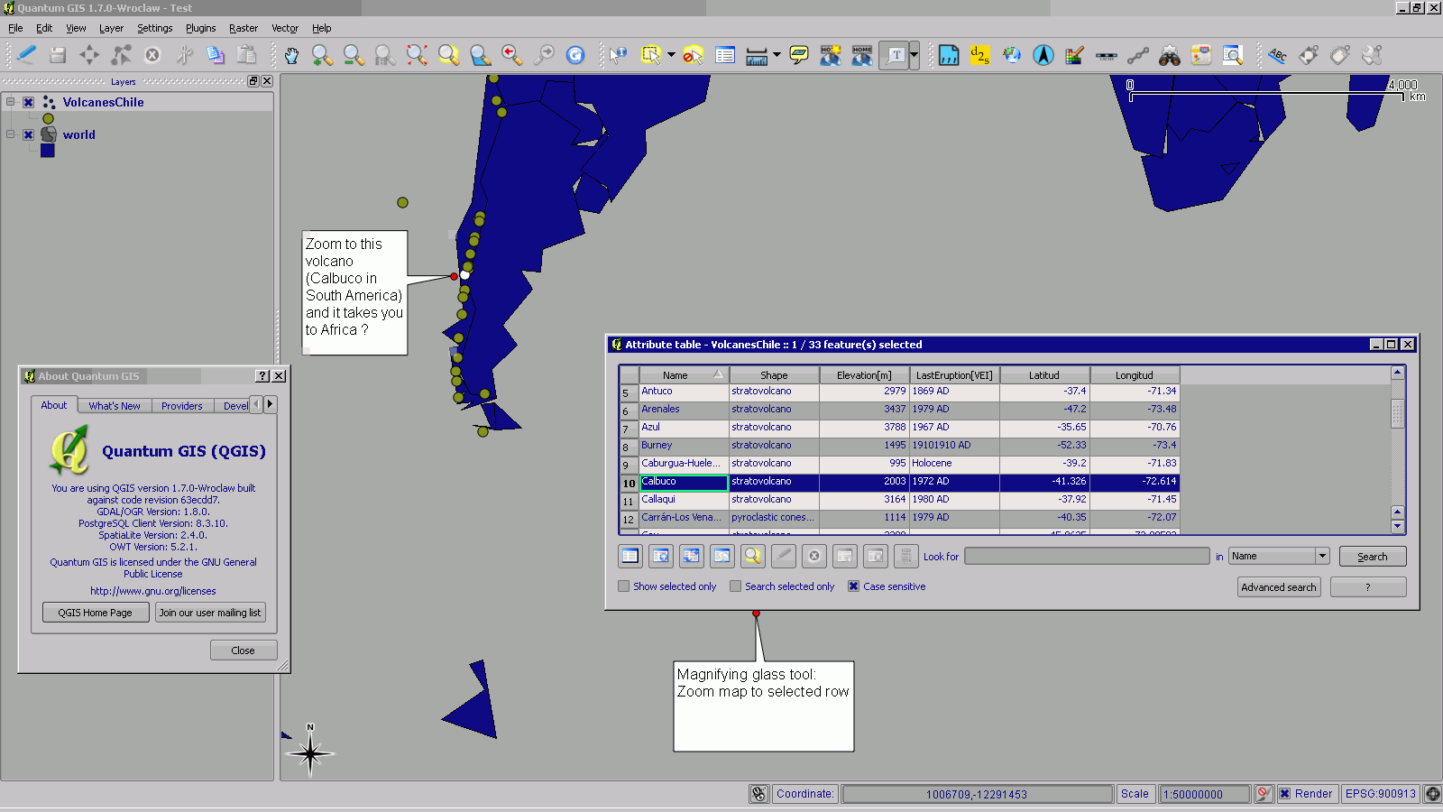
Testing this on QGIS 1.7.0, Win2k box: works OK on 1.6 version: regression.
The problem: one clicks on a feature found in South America and the map canvas zooms to Africa ?
It's worth noting that the CSV has some botched up conversion/parsing and contains missing coordinates that end up as lat 0.0 and lon 0.0, a kind of boundary condition, but that is a valid lat-long pair, anyway, it worked OK on QGIS 1.6.
History
#1
 Updated by Thaddeus - almost 15 years ago
- File Test.zip added
#2
 Updated by Jürgen Fischer almost 15 years ago
- Resolution set to fixed
- Status changed from Open to Closed
fixed in ef9e214