Bug report #19440

Corrupt Tif - created by Clip Raster by Extent
| Status: | Closed | ||
|---|---|---|---|
| Priority: | Normal | ||
| Assignee: | - | ||
| Category: | GDAL Tools | ||
| Affected QGIS version: | 3.2 | Regression?: | No |
| Operating System: | Easy fix?: | No | |
| Pull Request or Patch supplied: | No | Resolution: | invalid |
| Crashes QGIS or corrupts data: | No | Copied to github as #: | 27268 |
Description
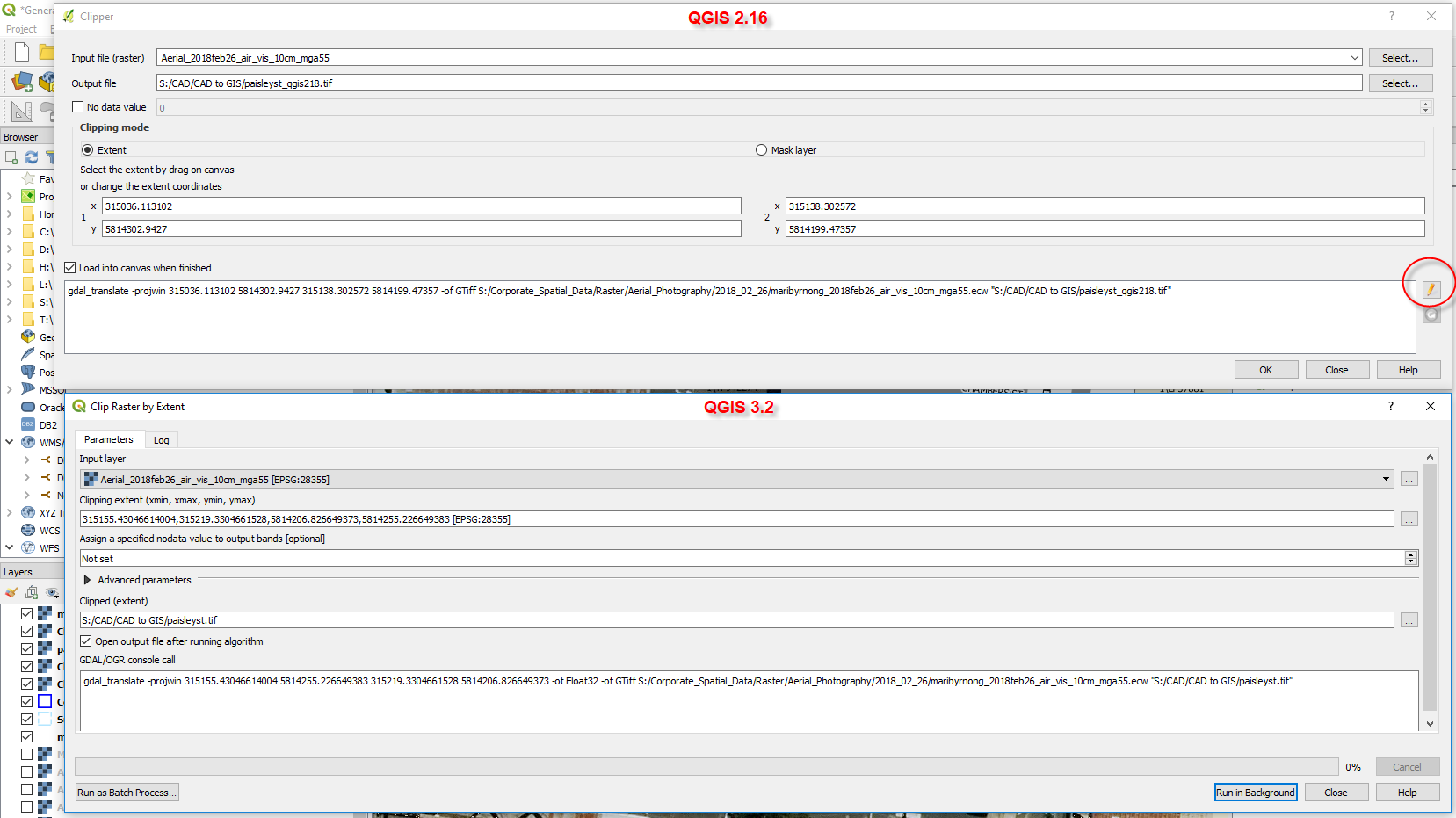
Using QGIS 3.2.0 I have tried to extract a small area of raster to be imported into autocad. The tif file generated by Clip Raser by Extent loads up fine in QGIS but will be corrupted or white in in application outside of QGIS.
This process worked fine in 2.18 but it was also possible to edit the gdal script generated by this tool if something wasn't working. The gdal script looks to add '-ot Float32' as standard now
History
#1
 Updated by Giovanni Manghi almost 8 years ago
- Status changed from Open to Feedback
In Processing you can expand the "advanced parameters" section and select a different output TIFF types (byte, int, float, etc.).
Please try and report back.
#2
 Updated by stuart mcdougall almost 8 years ago
thanks for the help, I have tested and AutoCad is only happy when the Tiff file is exported with an output data type set to Byte
#3
Updated by Giovanni Manghi almost 8 years ago
- Resolution set to invalid
- Status changed from Feedback to Closed