Feature request #19150

Automatically Use max image dimensions from WMS Capabilities
| Status: | Closed | ||
|---|---|---|---|
| Priority: | Normal | ||
| Assignee: | - | ||
| Category: | Web Services clients/WMS | ||
| Pull Request or Patch supplied: | No | Resolution: | |
| Easy fix?: | No | Copied to github as #: | 26980 |
Description
Some WMS servers have a limit on the maximum image size they serve.
These sizes are (optionally) announced in the capabilities document, tags MaxWidth and MaxHeight, see the OGC xsd at http://schemas.opengis.net/wms/1.3.0/capabilities_1_3_0.xsd .
When sizes are not explicitly set by the user to a supported value errors in plotting and printing occur, see #3768 .
QGIS should use the MaxHeight and MaxWidth capabilities values (if present) as the default for the "tile size" option in the "Add WMS layer" dialog, and possibly also warn on entering sizes that are too large.
Associated revisions
wms provider: avoid exceeding server limits by tiling the requests (implements #19150)
History
#1
 Updated by Tilman Brock-Hesse about 8 years ago
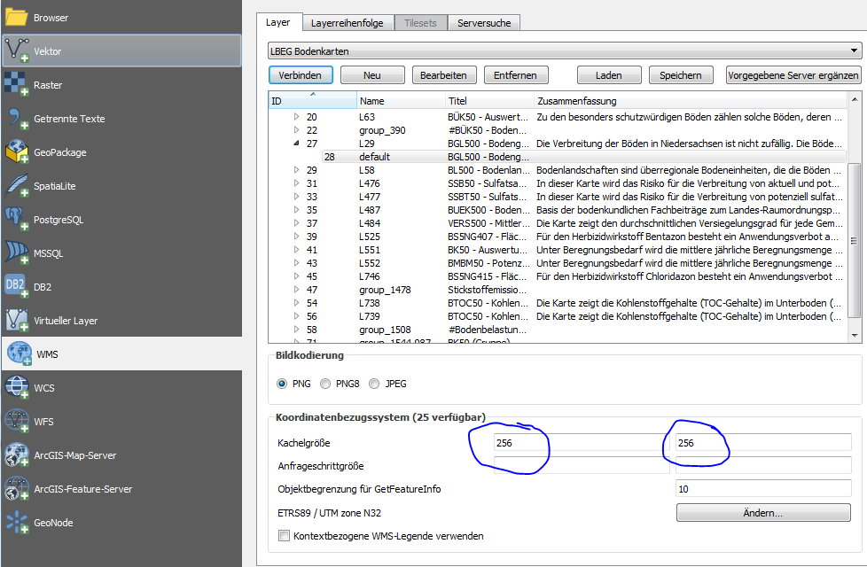
- File qgis-tilesize-lbeg.png added
See attached screenshot for the UI fields mentioned.
#2
 Updated by Jürgen Fischer about 8 years ago
- % Done changed from 0 to 100
- Status changed from Open to Closed
Applied in changeset qgis|b5d0c75027c8a30ca000ac061a5466f1c6287d1c.
#3
 Updated by Oliver Tonnhofer almost 8 years ago
Won't this slow down normal map movement (pan/zoom) for servers that allow large prints? If the server advertises a MaxWidth and MaxHeight of 10.000 pixels, then QGIS will make HUGE tile requests. Or am I missing something?