Bug report #1802

problem when using a geographic CRS after changing the central meridian
| Status: | Closed | ||
|---|---|---|---|
| Priority: | Low | ||
| Assignee: | |||
| Category: | Projection Support | ||
| Affected QGIS version: | Regression?: | No | |
| Operating System: | All | Easy fix?: | No |
| Pull Request or Patch supplied: | Resolution: | duplicate | |
| Crashes QGIS or corrupts data: | Copied to github as #: | 11862 |
Description
Tested with both shapefiles and postgis.
How to reproduce the problem:
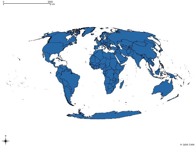
*) download this shapefile of the world borders http://thematicmapping.org/downloads/TM_WORLD_BORDERS-0.3.zip
*) add it to your project
*) add a custom CRS with the following definition (for example) "+proj=moll +lon_0=Central Meridian +x_0=False Easting +y_0=False Northing"
*) in the project properties choose the just created CRS and activate OTFR
*) the layer shows correctly
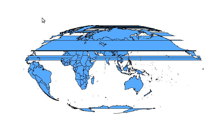
*) now go to the CRS management and change the central meridian "+proj=moll +lon_0=90 +x_0=False Easting +y_0=False Northing"
*) in the project properties change again to wgs84 and back again to the custom CRS, now the shape looks weird.
*) if you zoom in enough the problem disappear
History
#1
 Updated by Magnus Homann over 16 years ago
- Resolution set to duplicate
- Status changed from Open to Closed
This is a duplicate of #597. As you can see the American continent wraps around, which means the polygons should really by split.
Basically, you can't set up your projections such that geometries must be split.