Bug report #17414

Extents for Rotated Map Incorrect
| Status: | Closed | ||
|---|---|---|---|
| Priority: | Normal | ||
| Assignee: | - | ||
| Category: | Map Composer/Printing | ||
| Affected QGIS version: | 2.18.13 | Regression?: | No |
| Operating System: | Windows 10 | Easy fix?: | No |
| Pull Request or Patch supplied: | No | Resolution: | no timely feedback |
| Crashes QGIS or corrupts data: | No | Copied to github as #: | 25311 |
Description
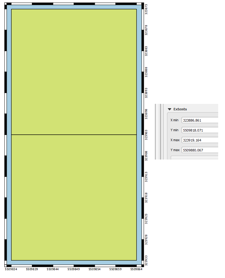
In map composer, if a map is rotated (by 90 degrees, for example) the extents no longer report the correct X and Y Min/Max values presented in the map. Using UTM project, it is clear that the X min/max coordinates are still in UTM easting, and the Y min/max are still in UTM northing, but the values are describing a different rectangle than what is presented in the map.
Attached image demonstrates the issue; compare coordinates along border (which are correct for content) with the extents given.
To replicate:
1) create rectangular content and take note of extents
2) create map in composer that is oriented orthogonally to the rectangular content
3) change Map Rotation to 90 degrees in Main Properties of the map
4) change size, shape, and scale of map so content is tightly encapsulated
5) compare extents presented in composer with known extent of content
History
#1
 Updated by Jürgen Fischer over 7 years ago
- Status changed from Open to Feedback
Please test with QGIS 3.4 - QGIS 2.18 reached it's end of life.
#2
 Updated by Giovanni Manghi over 7 years ago
- Resolution set to no timely feedback
- Status changed from Feedback to Closed