Feature request #16989

Add support for netCDF vector format
| Status: | Closed | ||
|---|---|---|---|
| Priority: | Normal | ||
| Assignee: | - | ||
| Category: | Data Provider/OGR | ||
| Pull Request or Patch supplied: | No | Resolution: | invalid |
| Easy fix?: | No | Copied to github as #: | 24888 |
Description
According to http://www.gdal.org/frmt_netcdf_vector.html GDAL 2.1 and later is now able to read and write netCDF vector data.
At least ogr2ogr -f netcdf points.nc points.vrt works for me on a given VRT file, and ogrinfo -al points.nc can read the output correctly.
It would be nice if that format could be added to the list of available formats in QGIS 3.x
History
#1
 Updated by Giovanni Manghi over 8 years ago
- Resolution set to invalid
- Status changed from Open to Closed
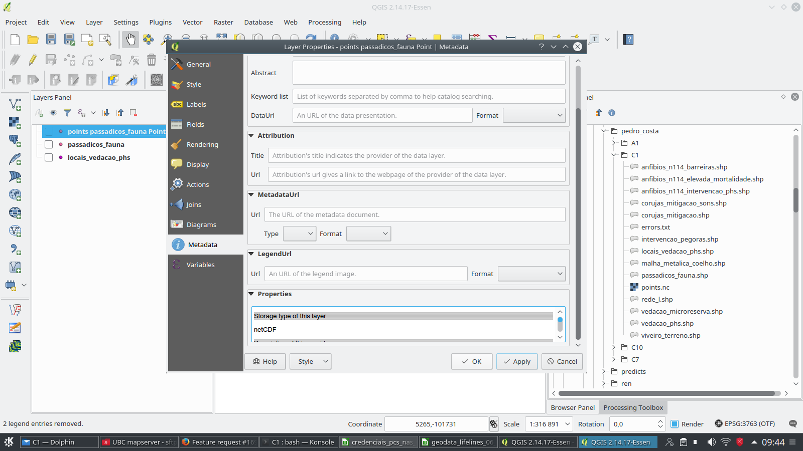
- File Screenshot_20170810_094442.png added
If you have a QGIS copy compiled with the proper GDAL version then it just works. See attached image. The problem I see is that the browsers "sees" that files as rasters layers, and loading from there it will fail. Would you mind opening a new ticket about that? thanks.
#2
 Updated by Andre Joost over 8 years ago
I searched the datatype in the "Add vector Layer" dropdown list, and did not find it there. With "All files" it seems to work as vector layer.