Bug report #15572

Some WMS service are displayed as empties because of bad SRS and view scale interpretation (msWMSLoadGetMapParams(): WMS server error. Unsupported SRS namespace (only EPSG and AUTO currently supported).)
| Status: | Closed | ||
|---|---|---|---|
| Priority: | Normal | ||
| Assignee: | - | ||
| Category: | Web Services clients/WMS | ||
| Affected QGIS version: | 2.8.9 | Regression?: | No |
| Operating System: | Windows | Easy fix?: | No |
| Pull Request or Patch supplied: | No | Resolution: | end of life |
| Crashes QGIS or corrupts data: | No | Copied to github as #: | 23496 |
Description
Working on our plugin, I encountered this strange behavior: a WMS layer is displayed in the layers list with its legend but there is nothing in the map canvas.
To reproduce:
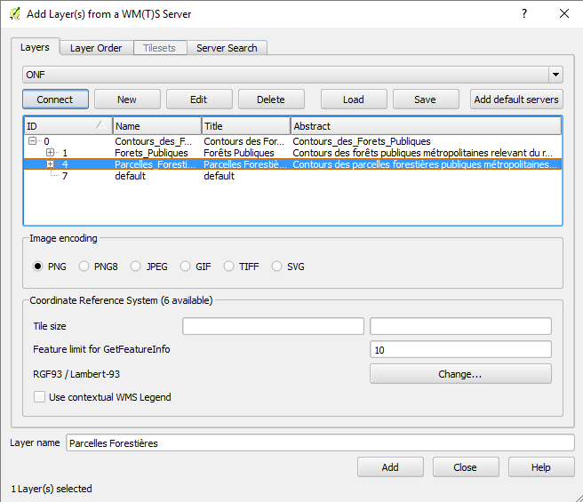
- open WMS client and add this WMS url: http://ws.carmencarto.fr/WMS/105/ONF_Forets
- when you press the "Connect" button, the list is displayed
- selecting the layer "Parcelles_Forestieres" the "Add" button is disabled and status bar displays "No CRS selected"
- select another layer and select back the layer, now "Add" button is enabled and CRS Lambert RGF93 (EPSG:2154) is set
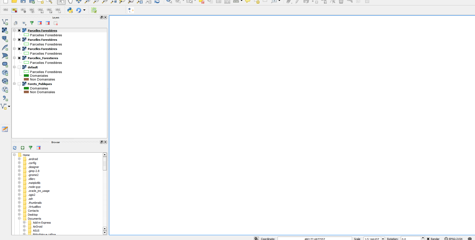
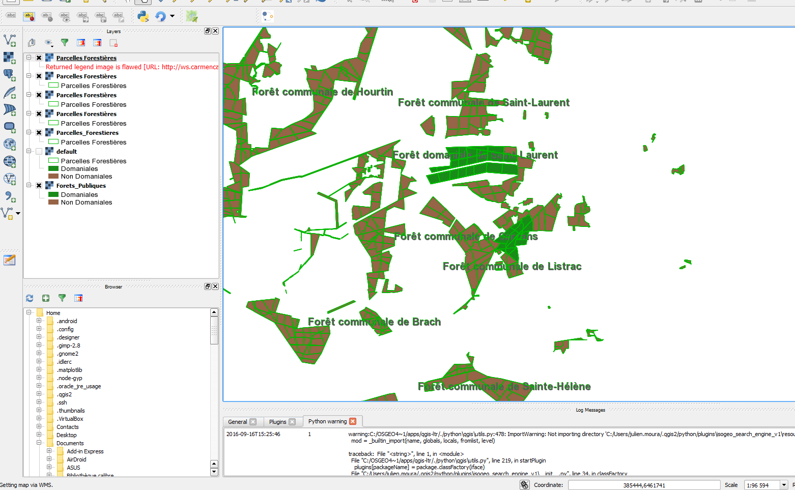
- clicking "Add" produces an empty mapcanvas but a legend present because the minimum scale visibility is not read from the server
=> there are messages in the log window, WMS tab (see screenshot)
Notice that:- the others layers from the same WMS service are okay (I unchecked on the screenshot but you can try)
StackTrace:
2016-09-16T15:12:40 1 Erreur de requête de carte (Statut : 200; Réponse :
<!DOCTYPE ServiceExceptionReport SYSTEM "http://schemas.opengis.net/wms/1.1.1/exception_1_1_1.dtd">
<ServiceExceptionReport version="1.1.1">
<ServiceException code="InvalidSRS">
msWMSLoadGetMapParams(): WMS server error. Unsupported SRS namespace (only EPSG and AUTO currently supported).
</ServiceException>
</ServiceExceptionReport>
; Type : application/vnd.ogc.se_xml; charset=ISO-8859-1; URL : http://ws.carmencarto.fr/WMS/105/ONF_Forets?language=fre&&SERVICE=WMS&VERSION=1.1.1&REQUEST=GetMap&BBOX=-5.58549999999999969,40.92079999999999984,10.75499999999999901,51.44619999999999749&SRS=CRS:84&WIDTH=916&HEIGHT=590&LAYERS=Parcelles_Forestieres&STYLES=&FORMAT=image/jpeg&DPI=96&MAP_RESOLUTION=96&FORMAT_OPTIONS=dpi:96)
Spotted on:
- QGIS 2.8.9 on Win10 AU (with OSGeo4W) in French
- and QGIS 2.14.6 on Win10 AU (with OSGeo4W) in English.
Related to
I looked into the issues archives but I just found out this very old issue: #1166.
History
#1
 Updated by Giovanni Manghi about 9 years ago
- Easy fix? set to No
- Regression? set to No
#2
Updated by Giovanni Manghi about 7 years ago
- Resolution set to end of life
- Status changed from Open to Closed
End of life notice: QGIS 2.18 LTR
Source:
http://blog.qgis.org/2019/03/09/end-of-life-notice-qgis-2-18-ltr/