Bug report #14338

Generated shapefile from custom application is not always displayed in QGIS
| Status: | Rejected | ||
|---|---|---|---|
| Priority: | Normal | ||
| Assignee: | - | ||
| Category: | Unknown | ||
| Affected QGIS version: | master | Regression?: | No |
| Operating System: | Windows | Easy fix?: | No |
| Pull Request or Patch supplied: | No | Resolution: | invalid |
| Crashes QGIS or corrupts data: | No | Copied to github as #: | 22325 |
Description
Hello,
I have an issue with Shapefiles opened in QGIS.
I developped an application with a class able to read data from an Oracle database, and convert them in Shapefile.
This class follows the ESRI specifications from here : https://www.esri.com/library/whitepapers/pdfs/shapefile.pdf
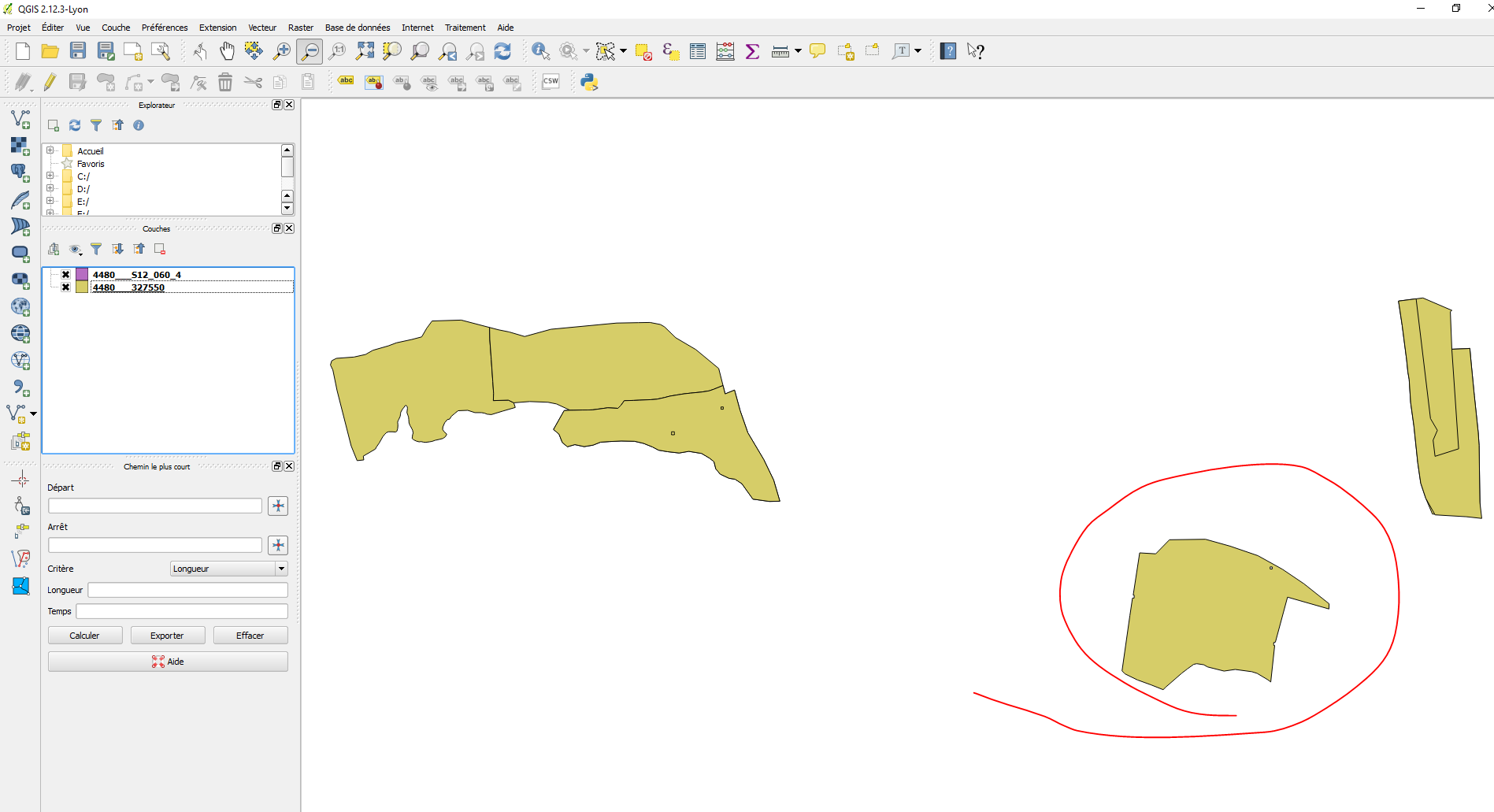
You can find in attach 2 samples :
- 4480___S12_060_4 : there is only one polygon, but it is not displayed on the map
- 4480___327550 : there are 8 polygons in this one, and all of them are well displayed
The strange thing is that the polygon from "4480___S12_060_4" is common with "4480___327550", but in one case it is not shown, and in the other case it is shown (see screenshot in attach)...
I have no problem when I open these files with MapInfo.
I don't have ArcMap to check on this side.
Are you able to check if it is a bug from the Shapefile or from QGIS ?
I spent some hours to check what's wrong, but I have no more ideas right now...
Many thanks.
History
#1
 Updated by Saber Razmjooei over 10 years ago
- Resolution set to invalid
- Status changed from Open to Rejected
SAGA also can't read your file.
It is an issue with your implementation.
#2
 Updated by Jürgen Fischer over 8 years ago
- Category set to Unknown