Bug report #12780

Correct GML interpreted as plain table when XSD is present
| Status: | Closed | ||
|---|---|---|---|
| Priority: | Normal | ||
| Assignee: | - | ||
| Category: | Data Provider/OGR | ||
| Affected QGIS version: | 2.6.1 | Regression?: | No |
| Operating System: | Windows | Easy fix?: | No |
| Pull Request or Patch supplied: | No | Resolution: | up/downstream |
| Crashes QGIS or corrupts data: | No | Copied to github as #: | 20879 |
Description
I'm not sure if this is a bug or not. I have a correct GML file, and it is interpreted as geospatial data by QGIS, but when I add the accompanying XSD-file, the GML is interpreted as a plain table (i.e. the spatial part is not recognized).
See files attached:
Refgew.gml with Refgew.xsd is interpreted as plain attribute table
Refgew2.gml (having no internal link to Refgew.xsd) is interpreted as a geospatial dataset
File source: https://download.agiv.be/Producten/Detail?id=10&title=Voorlopig_referentiebestand_gemeentegrenzen
Refgew.gml (651 KB)
Refgew.xsd  (3.27 KB)
Refgew2.gml (651 KB)
Voorlopig_referentiebestand_gemeentegrenzen_Gml.zip (4.58 MB)
2015-05-26_232432.png (209 KB)
History
#1
 Updated by Saber Razmjooei over 10 years ago
- Status changed from Open to Feedback
Works for me in master.
#2
 Updated by Joeri Theelen over 10 years ago
- File Voorlopig_referentiebestand_gemeentegrenzen_Gml.zip added
- File 2015-05-26_232432.png added
- Assignee set to Saber Razmjooei
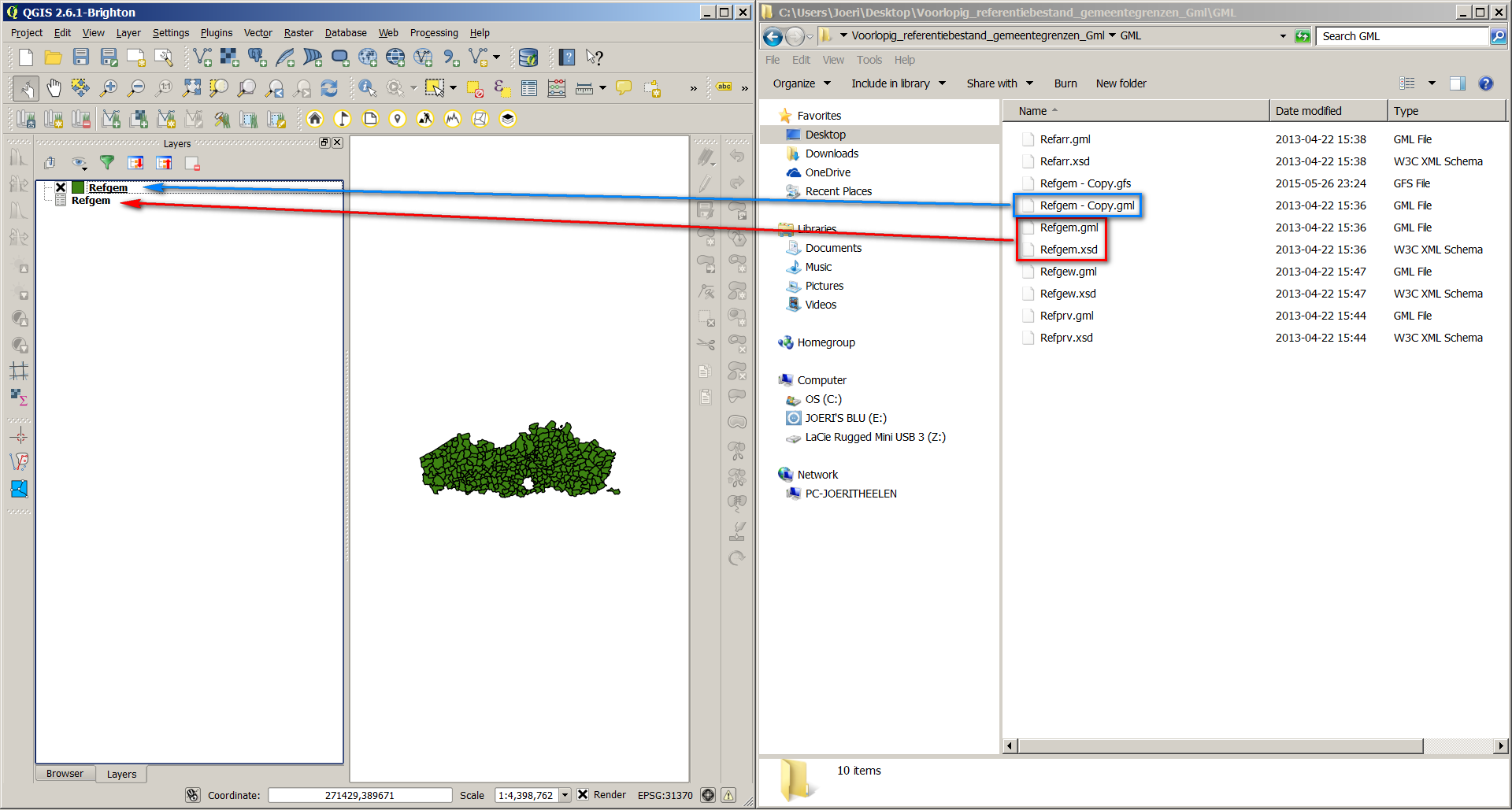
Hi, thanks for looking into this. Yes, I've noticed that, with the files that I have uploaded in my original post, the GML with XSD is interpreted correctly (in QGIS 2.6 and 2.8). Strange. However, I have downloaded the original file again from our governments website, having administrative borders in Flanders. You can find the original download attached. I tried again, and it's still not interpreted correctly. See screenshot attached. Refgem.gml + Refgem.xsd (in red) is a plain table. "Refgem - Copy.gml" is the same file as "Refgem.gml", but it does not share the filename-part with the XSD: it is interpreted as a geospatial dataset (blue) as it should be. Maybe using the original download you'll be convinced that there is something wrong here.
#3
 Updated by Giovanni Manghi over 10 years ago
- Status changed from Feedback to Closed
- Resolution set to up/downstream
- Assignee deleted (
Saber Razmjooei)
Not a QGIS issue.
Try this two ogr commands:
ogrinfo Refgem.gml Refgem
and
ogrinfo Refgem-copy.gml Refgem
you will see that in the first case only attributes will be presented, in the second case also the geometry part.
#4
Updated by Joeri Theelen over 10 years ago
- Assignee set to Giovanni Manghi
So what you are saying is that this is an OGR issue then? Or is the XML Schema not valid? I cannot test this now, but I remember checking it in XML Spy and the GML and XML Schema were both valid. However, I checked using the Java 8 just now, and there seems to be an issue: Cannot resolve the name 'gml:_FeatureCollection' to a(n) 'element declaration' component.
Anyway, I want to give the person responsible for creating these GML-files valuable feedback: so is it OGR or the XML Schema?
Thanks.
#5
Updated by Giovanni Manghi over 10 years ago
- Assignee deleted (
Giovanni Manghi)
Anyway, I want to give the person responsible for creating these GML-files valuable feedback: so is it OGR or the XML Schema?
with that xml schema ogr does not shows the geometries, so still unclear to me if is ogr or the schema. Better file a ticket on ogr tracker.
#6
Updated by Joeri Theelen over 10 years ago
Ok, thanks for the advice: I have posted this on the OGR issue tracker here:
https://trac.osgeo.org/gdal/ticket/5977
Cheers.