Bug report #12577

On the fly projection in molweide results in polygons displayed as squares
| Status: | Closed | ||
|---|---|---|---|
| Priority: | Normal | ||
| Assignee: | - | ||
| Category: | Projection Support | ||
| Affected QGIS version: | master | Regression?: | No |
| Operating System: | Linux (Ubuntu) | Easy fix?: | No |
| Pull Request or Patch supplied: | No | Resolution: | wontfix |
| Crashes QGIS or corrupts data: | No | Copied to github as #: | 20702 |
Description
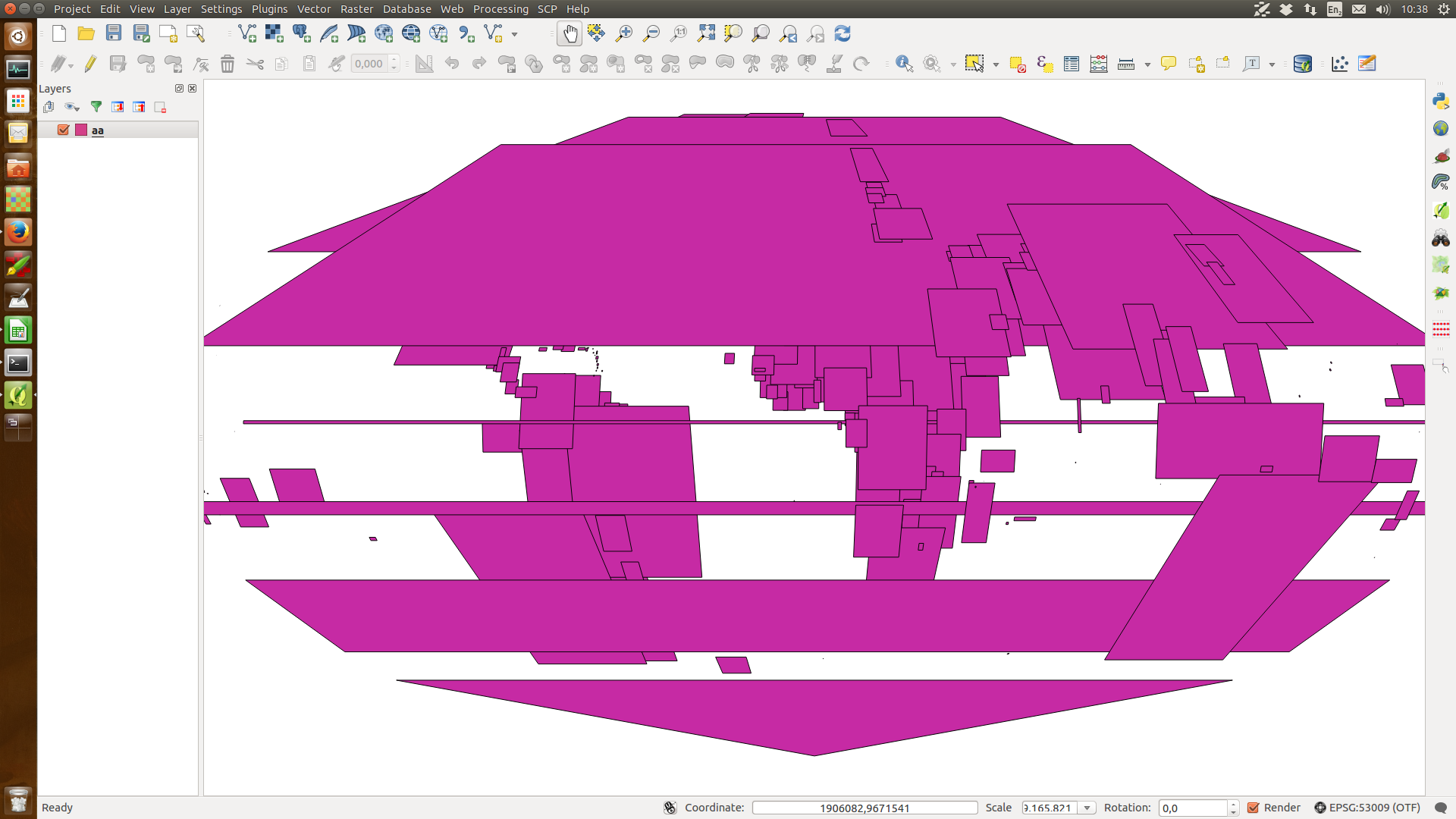
I have a vector layer with the country boundaries (EPSG 4326) and want to use the on the fly projection to display the map in world_molweide (EPSG:54009) and sphere_molweide (EPSG:53009) or world_robinson (EPSG:54030) and sphere_robinson (EPSG: 53030). However, what I get is countries displayed as squares. Only when zooming in considerably (about 1:50 million), the map is displayed correctly.
Reprojecting the layers, using the QGIS 'reproject layer' function works without problems.. when opening such reprojected layer they are displayed correctly, also when for example setting the project projection to EPSG 4326 with OTF.
History
#1
 Updated by Giovanni Manghi over 11 years ago
- Resolution set to wontfix
- Status changed from Open to Closed
- Category set to Projection Support
Enter the vector properties and disable the geometry simplification, option. I just tested and it solves the issue.
#2
 Updated by pvanbosgeo - over 11 years ago
Great, that worked, thanks.
Giovanni Manghi wrote:
Enter the vector properties and disable the geometry simplification, option. I just tested and it solves the issue.