Bug report #12371

projection problems
| Status: | Closed | ||
|---|---|---|---|
| Priority: | Normal | ||
| Assignee: | - | ||
| Category: | Projection Support | ||
| Affected QGIS version: | 2.8.1 | Regression?: | No |
| Operating System: | Easy fix?: | No | |
| Pull Request or Patch supplied: | No | Resolution: | invalid |
| Crashes QGIS or corrupts data: | No | Copied to github as #: | 20546 |
Description
hello, I have used QGIS for several years. The software is great.
But I am not very satisfied with map projection, especially for some classical projection.
When I downloaded for example 'Admin 0 – Countries' data from Natural Earth webpage and do some projection, some issues arouse.
Mercator projection for example, in QGIS 1.8.0, Antarctica disappeared;in QGIS 2.2.0 and QGIS 2.6.1, the bottom of Antarctica converge to a point located on the top-left of the screen.
For azimuthal equidistant projection, the pole projection is OK in QGIS 2.6.1, but when I changed the origin to 'lat_0=31, lon_0=35' for example, many polygons overlap.
Hope the projection functionality would be robust in new versions.
History
#1
 Updated by Giovanni Manghi almost 11 years ago
- Category set to Projection Support
- Status changed from Open to Feedback
Hi,
could you provide a few practical examples attaching sample projects (with sample data) or screenshots/screecasts?
thanks.
#2
 Updated by Kun Zhang almost 11 years ago
- File Mercator_EPSG_3857.jpg added
#3
Updated by Kun Zhang almost 11 years ago
- File aedq.jpg added
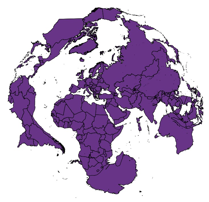
Hi, please look at the picture attached.One is in Mercator projection (EPSG:3857).
Another is in azimuthal equidiatant projection, the proj4 string is :
+proj=aeqd +lat_0=31 +lon_0=35 +x_0=0 +y_0=0 +datum=WGS84 +units=m +no_defs
the world file is 'Admin 0 – Countries' from Natural Earth. Both projection are done in QGIS 2.6.1
thanks for attention.
#4
 Updated by Raymond Nijssen about 10 years ago
- File aedq.png added
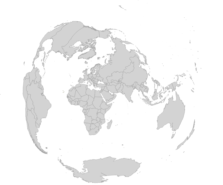
You might be using the wrong projection parameters. When I try this one it looks as I expected:
+proj=aeqd +lat_0=31 +lon_0=35 +x_0=0 +y_0=0 +a=6371000 +b=6371000 +units=m +no_defs
Please try again and let us know if it works. Thanks!
According to epsg 3857, this projection only covers latitudes up to about 85 degrees north and south. I guess your data is out of these bounds and not truncated the proper way. I'm using an other world data set and it looks quite ok on my screen.
#5
Updated by Giovanni Manghi about 10 years ago
- Resolution set to invalid
- Status changed from Feedback to Closed
closing for lack of feedback.