Bug report #11568

Problemi con la stampa
| Status: | Closed | ||
|---|---|---|---|
| Priority: | Normal | ||
| Assignee: | - | ||
| Category: | - | ||
| Affected QGIS version: | 2.4.0 | Regression?: | No |
| Operating System: | Easy fix?: | No | |
| Pull Request or Patch supplied: | No | Resolution: | invalid |
| Crashes QGIS or corrupts data: | No | Copied to github as #: | 19830 |
Description
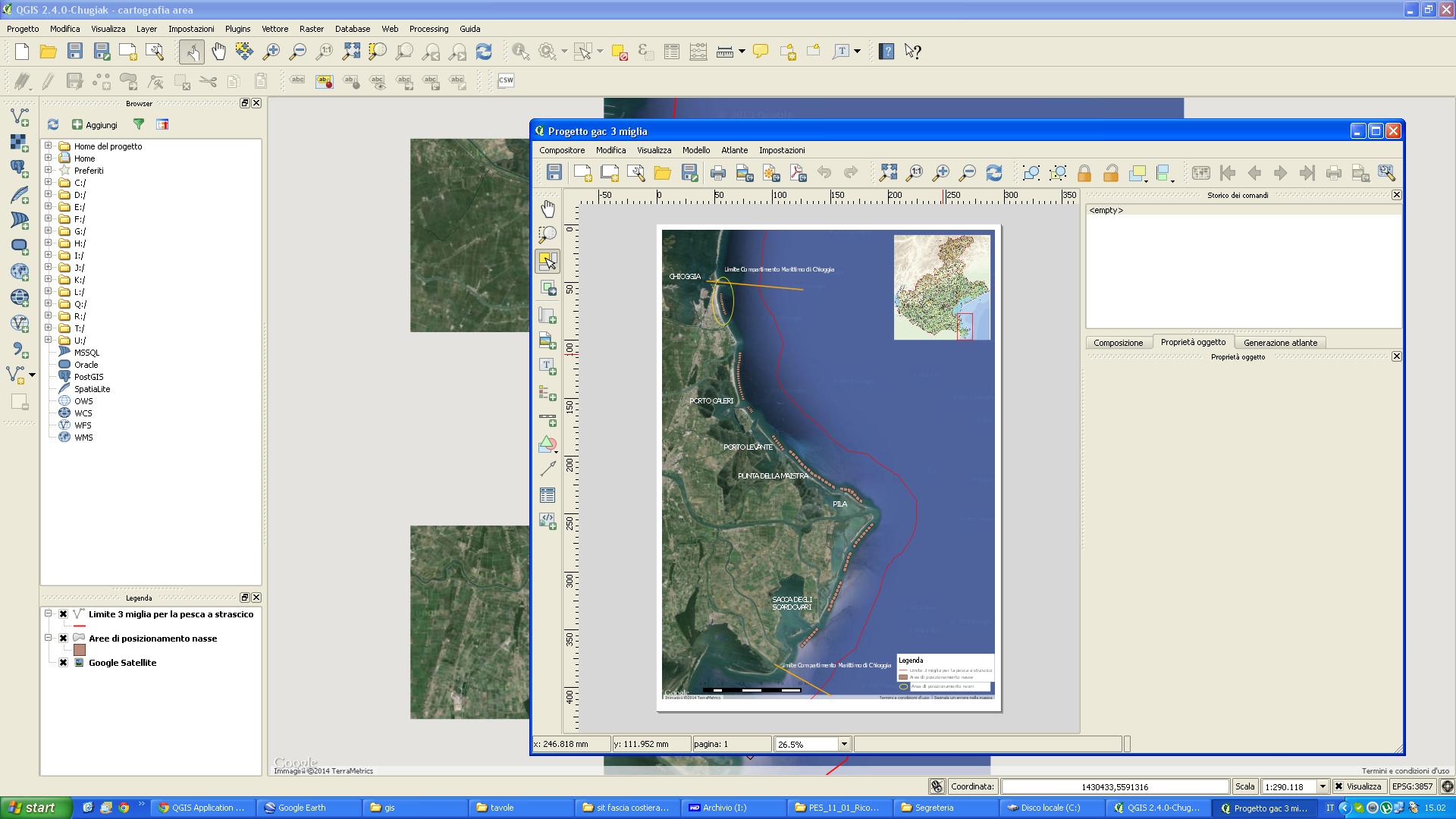
Salve ho iniziato ad usare qgis per un progetto europeo che lo chiedeva e visto che è molto agevole nell'uso lo sto adoperando anche come alternativa a arcgis. Solo che adesso ho esigenza di stampare una tavola ma mentre a video la vedo perfetta, in fase di stampa mi si sfasa tutto. Sia che faccio la stampa pdf con stampante sia che esporto in pdf il file con l'apposita funzione. Sapete dirmi dove sbaglio? In allegato metto printscreen della tavola come dovrebbe essere e come viene in stampa.
Grazie
History
#1
 Updated by Giovanni Manghi over 11 years ago
- Resolution set to invalid
- Status changed from Open to Closed
Hi,
tickets here must be filed in English.
Regarding your issue:
the layers added from the OpenLayers plugin are known to have limitations when printed trough the composer. Your best chance is try to print using a scale that is one of the predefined scales by providers like google, osm, bing, etc. You should also try using the Google Mercator CRS for your project.
If this does not works you have alternatives: use a source that is in a standard format (like WMS, there is one that publish maps from Bing) or use the "save as image" functionality that will create a georeferenced image that you can re-add in QGIS and print without hitting the above limitations.