Bug report #19593
"Classify" button in graduated symbology may make too small a range
| Status: | Open | ||
|---|---|---|---|
| Priority: | Normal | ||
| Assignee: | - | ||
| Category: | Symbology | ||
| Affected QGIS version: | 3.2.1 | Regression?: | No |
| Operating System: | Ubuntu 16.04.5 | Easy fix?: | Yes |
| Pull Request or Patch supplied: | No | Resolution: | |
| Crashes QGIS or corrupts data: | No | Copied to github as #: | 27420 |
Description
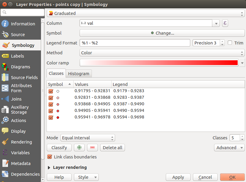
Auto-classified ranges that are created on the graduated symbology preference panel may not include features at the extremes of the field used for the ranges.
Procedure
- Load the attached [[attachment:file.zip]] into QGIS
- Open the layer properties / symbology
- Select "Graduated"
- Select "val" as the column
- Select "Classify" to generate 5 classes from the data
- Hit "Okay" to return to the main view

Expected
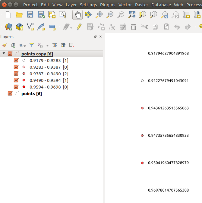
When looking at the correct location on the map, all 6 points are visible. Points are located at (0,0) (10,0) (20,0) (30,0) (40,0) (50,0).
Actual
When looking at the correct location on the map, only 4 points are visible. The points with the lowest and highest values are outside of the generated categories and are not displayed. See the attached image (which has a duplicate of the initial layer to show text where the points should be.)
