QGIS Mapserver
Now part of the main code base. A WMS 1.3 compatible WMS server that can use a regular .qgs project file as configuration. Alternatively one can provide an SLD file for the configuration.
Link to more info (e.g. Tim Sutton's blog)
Layers
- Nested Groups and Layers
- Multiple layers selectable to move or delete
Label enhancements
- Suppressing labeling of short linestrings (only for linestring geometries)
- Support of multiline labels in the new label engine (only for point geometries)
- Support of data-defined label properties in the new label engine, such as font-family, size, color, position and rotation
- Support of data-defined text anchors (left, center, right; top, cap, half, base, bottom)
- Support of direction symbols (<, >) for indicating the direction of a line in a text label (only for linestring geometries)
Data Providers
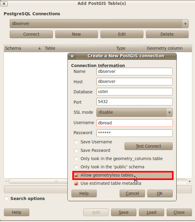
Postgis
- Geometry-less (attribute only) tables can now be loaded
Symbolization and Classification
In the "Graduated Renderer" there are the following new classification methods available:
- Natural Breaks (Jenks)
- Standard Deviation
- Pretty Breaks
Misc
(1.5.0 branched at 13918)
- composer:
- sorting in attribute table
- Offline editing plugin
- GPSD support in "Live GPS Tracking"
- feature form callable from plugins
- OGR creation options
- SJJB icons added
- advanced selection tools added
- WFS-T support