QGIS understands three major forms of data. Two of these are spatial (ie, they contain information allows it to be shown in space) and the third contains no spatial data (" aspatial data")
The two spatial data types are:- Vector data. Vector data can be drawn by lines of varying lengths; that is points, lines or polygons. In QGIS vector files can only contain one of these three types in a file.
- Raster data. These are images, jpg, tif, etc. These files are accompanied by or contain information that allows them to be shown in space.
This technical note shows a process for adding a raster layer to your QGIS project --- and it's easy.
mActionAddRasterLayer.png
Plugins : None
Description
Click on the the Add Raster Layer button

Add raster layer button
Fill in the box. You can browse to a location using this dialogue box.

A completed dialogue box that will open the Alaska Landcover image
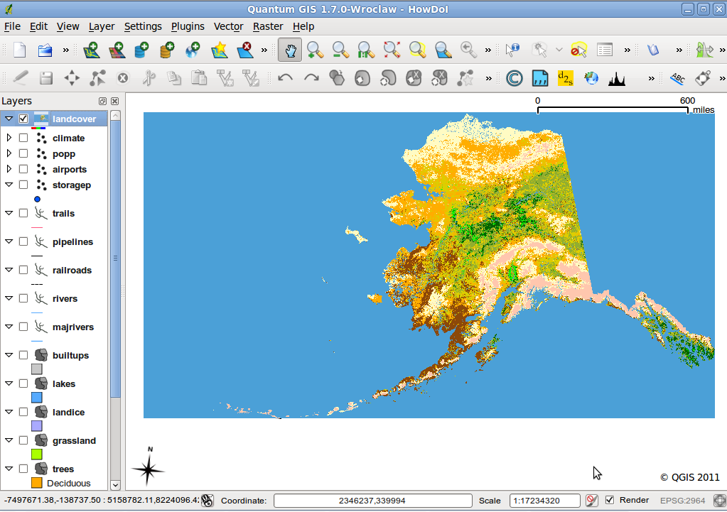
Once everything is filled in on the main dialogue, just hit open and you're done.

The Alaska landcover image
Notes
- You can also open a raster layer using Layer → Add raster layer or the keyboard shortcut.
- A full list may be found at \href{http://www.gdal.org/formats_list.html}. You can filter for different file types in the browse dialogue.
- Be very aware of projections. More so than vector files, raster files seem to come without projection information either built-in or a world type file. If QGIS is unsure about what projection to display a file it defaults to opening the file in the default projection - WGS84.
- If a file is opened in the wrong projection, this can be changed. Right click on the relevant layer, and choose "Set layer CRS".
- Both the default for what to do when QGIS doesn't know the projection and the default projection can be changed.
- As of 1.8 GIS will place a new layer in the TOC above any layer you have selected.